
Drone Inspection Services in Austin, TX

Need professional drone inspection services in Austin, TX, for your next commercial project? We handle thermal imaging, orthomosaics, point clouds, and CAD-ready deliverables, backing every job with engineering reports built for construction, infrastructure, energy, and industrial work. Our drone inspection in Austin approach focuses on accuracy your team can actually build decisions around, project after project, without cutting corners.

WHAT CAN WE DO FOR YOU?

Check Out Our Services in Austin, TX

Engineering, construction, infrastructure, and energy companies across Austin turn to us for commercial drone work that holds up under scrutiny. Mapping and thermal imaging are our bread and butter, but UAV inspection services in Austin also cover asset checks and survey support, all producing the kind of geospatial data that makes project planning less of a guessing game, whatever industry or project size you’re working with.

Drone Inspection

Industrial facilities, energy assets, construction sites, and infrastructure all need eyes in the air, and that’s where our drone inspection services in Austin come in. We fly, we assess, and we hand back reports detailed enough to catch problems before they become expensive ones, which makes maintenance planning and site safety a lot more manageable.

Drone Aerial Photography

Drone Aerial Photography Services

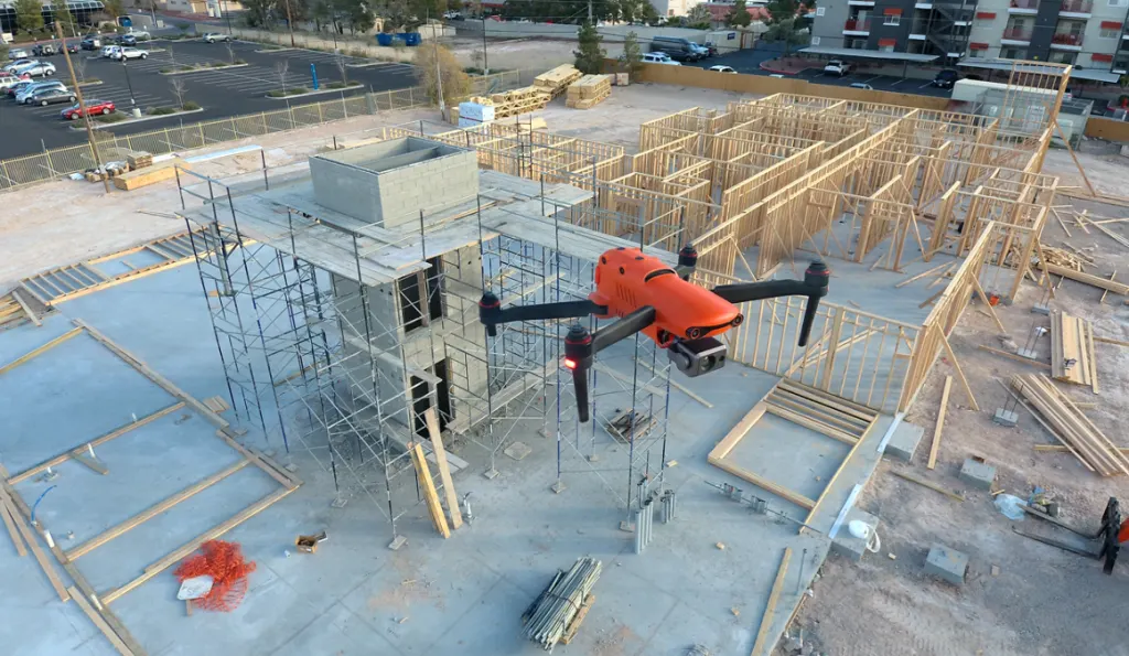
Commercial developments, engineering documentation, infrastructure projects, and construction progress all photograph differently from the air, and that’s the angle we specialize in. Our Drone Aerial Photography services in Austin give project managers something concrete to share with stakeholders and a running visual record of the site as work moves forward.

Drone Thermal Imaging

Drone Thermal Imaging Services in Houston

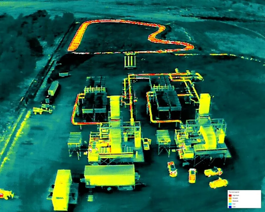
Heat doesn’t lie, which is why our Drone Thermal Imaging in Austin catches equipment failures, electrical hotspots, insulation gaps, and structural anomalies that a visual pass alone would miss. The reports we deliver give engineering and maintenance teams a real head start on cutting downtime and keeping assets running the way they should.

Drone Mapping & Photogrammetry

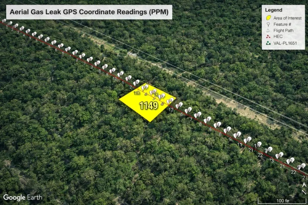
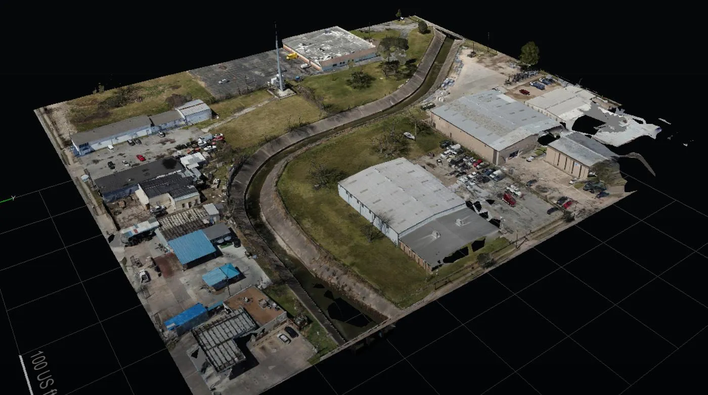
Survey-grade orthomosaics, point clouds, 3D terrain models, and CAD-ready files come standard with our UAV Drone Mapping services in Austin. Engineering and infrastructure teams rely on this kind of mapping when the margin for error is small, and our drones are built to capture geospatial data precise enough to plan and design around with confidence.

LEARN MORE ABOUT US

Who are we?

Professional Drone Services of Texas got its start helping engineering, construction, industrial, and energy companies see their sites the way an inspector would, but from the air. Our drone inspection services in Austin now support complex commercial projects across the region, giving clients aerial intelligence they can trust from the first survey to the final report.

Our Key Deliverables:

Why Choose Professional Drone Services of Texas

Reasons to Trust

We pair real drone expertise with dependable drone inspection in Austin, engineering-grade mapping, and reports your team can actually act on.

Your Best Choice

From thermal inspections to orthomosaics, point clouds, and CAD-ready files, businesses keep coming back to us for commercial drone mapping done right.

Right Choice for You

Our aerial inspection services in Austin give you the accurate intelligence and survey support that makes planning, coordination, and safety easier.

Professional

Certified and experienced, our UAV inspection services in Austin team delivers precise inspections, thermal imaging, and mapping built for serious jobs.

Google Review

Write a Review

Top Rated Drone Inspection Services in Austin, TX

When construction, engineering, energy, and infrastructure companies need drone inspection services in Austin, TX, they can rely on Professional Drone Services of Texas. Thermal imaging, asset inspections, orthomosaics, point clouds, CAD-ready deliverables, and engineering reports come together here to help commercial and industrial clients make smarter calls before the next phase of work begins, whether that’s a small maintenance check or a full-scale infrastructure survey.

Check Out Our Gallery

Proudly Serving Austin, TX & Central Texas

Professional Drone Services of Texas is proud to support project teams across Austin and the Central Texas region. From downtown job sites and industrial yards to energy facilities and growing suburbs like Round Rock, Georgetown, Cedar Park, Pflugerville, and Kyle, our crews arrive prepared and ready to fly. We work around your schedule, handle site access details, and deliver clear, usable data without delays. Whether your project sits in the heart of the city or out in the Hill Country, you get a responsive local team that treats every job with care. Call us today to talk through your timeline, location, and project goals.

Call Us Now

Ready to get drone inspection in Austin, mapping, thermal imaging, or engineering support scheduled for your project? Professional Drone Services of Texas is one call away. We bring accurate aerial data, clear reporting, and deliverables built around what your commercial or industrial project actually needs, not a generic template pulled off a shelf and applied to every job in exactly the same way, regardless of scope.

Frequently Asked Questions

What are drone inspection services in Austin, TX?
Drone inspection services in Austin, TX use UAVs to capture high-resolution imagery and thermal data of industrial facilities, energy assets, construction sites, and infrastructure. Professional Drone Services of Texas turns that data into engineering reports that help teams spot problems early and plan maintenance with confidence.
Construction, engineering, energy, industrial, and infrastructure companies benefit most. UAV inspection services in Austin reduce the need for lifts, scaffolding, and climbing, keep crews safer, and deliver accurate aerial data for asset checks, progress tracking, and survey support on projects of any size.
A drone inspection in Austin typically produces thermal inspection reports, orthomosaics, point clouds, CAD-ready deliverables, and engineering reports. Everything is tailored to your project scope, so your team gets data it can use directly for planning, design, and maintenance decisions.
Yes. Thermal imaging reveals electrical hotspots, equipment failures, insulation gaps, and structural anomalies that are invisible to the naked eye. Catching these issues early helps engineering and maintenance teams cut downtime, avoid costly repairs, and keep assets running the way they should.
How accurate is commercial drone mapping for engineering projects?
Commercial drone mapping delivers survey-grade orthomosaics, point clouds, and 3D terrain models precise enough for engineering and infrastructure planning. Final accuracy depends on site conditions and ground control, so we match the capture workflow to your project’s tolerance requirements.
Generally, yes. Aerial inspection services in Austin keep personnel off roofs, towers, and elevated structures, lowering fall and exposure risks. Drones also cover large or hard-to-reach areas faster, which shortens site downtime while still capturing detailed, documentable inspection data.
Pricing depends on site size, inspection type, sensors required, and the deliverables you need. Professional Drone Services of Texas provides custom quotes instead of flat rates. Call (832) 856-8556 or use our Request a Quote page with your project details for a fast, accurate estimate.
Our certified, experienced team pairs accurate aerial data with clear reporting built around your project, not a generic template. Clients on Google consistently praise our responsiveness and quality, and every job ends with deliverables engineers and project managers can act on right away.

CONTACT US

You Can Contact Us Any Time

Request a Quote