Drone Service

Utility Infrastructure: Why Inferred Drone Services Make Sense

Inferred Drone Service

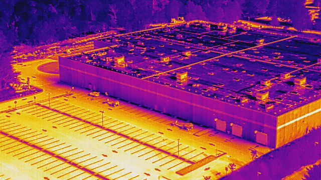
Utilities power cities, industries, and homes — but their infrastructure is often spread out, aging, and hard to access. Aerial inspection is changing that fast. With drone technology advancing, more companies are turning to inferred drone services to improve how they manage and inspect utility networks. What Are Inferred Drone Services? Inferred drone services use Utility Infrastructure: Why Inferred Drone Services Make Sense

Drone Mapping Accuracy: What Commercial Developers Need to Know

Drone Mapping

Accuracy matters more than ever in commercial development. A few inches off can mean budget changes, legal issues, or safety concerns. That’s why more developers are turning to Drone Mapping Companies to streamline project planning and site analysis. Let’s break down the tech that drives it all—GPS, RTK, LiDAR, and photogrammetry—in plain, easy-to-understand terms. The Drone Mapping Accuracy: What Commercial Developers Need to Know

Exploring the Benefits of Professional Drone Services

Drone Service

Technology is changing how businesses inspect, survey, and monitor their properties. Traditional inspection methods take time, cost a lot, and can be risky. Drone service near you offers a fast and cost-effective way to gather data, improve safety, and enhance efficiency. From real estate assessments to construction monitoring, drones provide accurate insights that help businesses Exploring the Benefits of Professional Drone Services