Drone Photogrammetry
Drone mapping and photogrammetry provide fast, accurate, and scalable data collection for construction, commercial, and industrial projects.
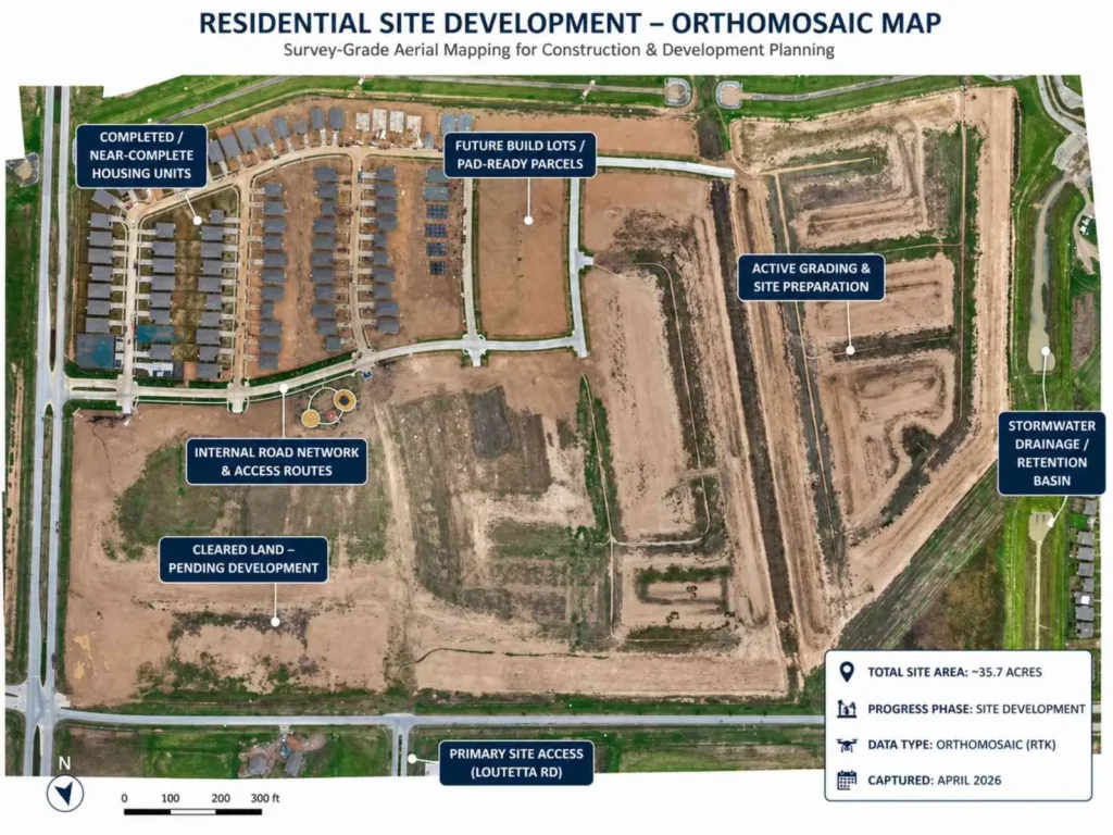
At Professional Drone Services of Texas, we deliver more than aerial imagery—we provide measurable, survey-grade outputs including orthomosaics, 3D models, and site data your team can actually use.
From progress tracking to site analysis, our mapping solutions help you make better decisions with accurate, up-to-date information.
Capture high-resolution aerial data across large areas with consistent accuracy. Our drone mapping workflows generate detailed orthomosaic maps and 3D models that allow your team to measure, analyze, and monitor project sites with confidence.
Whether it’s construction progress, land development, or infrastructure, you get reliable data—not estimates.
Traditional survey methods can take days or weeks. Drone mapping allows for rapid data capture and faster delivery of usable outputs.
We collect large volumes of site data in a single flight and deliver processed results quickly—so your team can move forward without delays.
Drone mapping significantly reduces the need for manned aircraft, extensive field crews, and repeated site visits.
You get high-quality, measurable data at a lower cost, while improving efficiency across your project.
Repeatable flight plans allow for consistent data capture across multiple site visits.
Compare datasets over time to monitor progress, identify changes, and maintain accurate project documentation throughout the lifecycle of your project.
Our deliverables are designed for real-world use—not just visuals.
3D models and point clouds
Elevation data and site measurements
CAD-ready outputs for engineering and planning
This allows your team to analyze, measure, and act with confidence.
We support construction firms, developers, engineers, and asset managers across Texas with reliable drone mapping services.
From single-site projects to multi-location operations, we provide consistent, scalable data capture tailored to your needs.