Drone Thermal Imaging
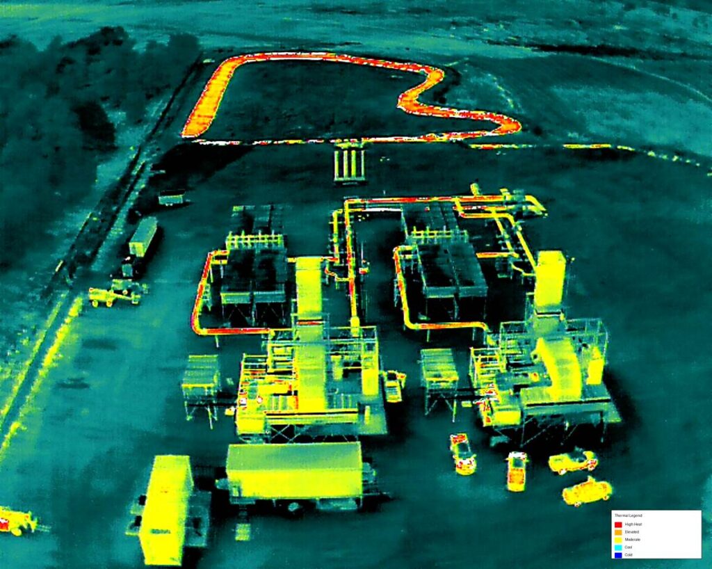
Drone thermal imaging services utilize advanced infrared sensors mounted on unmanned aerial systems (UAS) to detect temperature variations that are invisible to the naked eye. Thermal drones provide actionable data for inspections, diagnostics, and monitoring across multiple industries, including energy, construction, agriculture, and public safety. By capturing precise thermal data from the air, drone-based thermal imaging improves accuracy, reduces inspection time, and enhances operational safety.
Thermal imaging drones capture radiometric data that allows operators to measure surface temperatures and identify anomalies in real time. These datasets are processed into thermal maps and annotated imagery that clearly highlight heat signatures, energy loss, moisture intrusion, and equipment inefficiencies. Repeatable flight paths ensure consistent data collection for trend analysis and long-term monitoring.
Drone thermal imaging is commonly used for electrical inspections, solar panel analysis, roof and building envelope assessments, and mechanical system evaluations. Thermal drones can quickly identify overheated components, insulation deficiencies, and water intrusion without physical contact or system shutdowns. This non-invasive approach minimizes downtime while delivering accurate, decision-ready information.
Using drones equipped with thermal sensors significantly reduces the need for personnel to access hazardous or hard-to-reach locations. Aerial thermal inspections eliminate the need for scaffolding, lifts, or manual climbing, improving safety and reducing labor costs. Faster data collection and analysis help organizations detect issues early, preventing equipment failure, energy loss, and costly repairs.