Construction Mapping & Progress Tracking
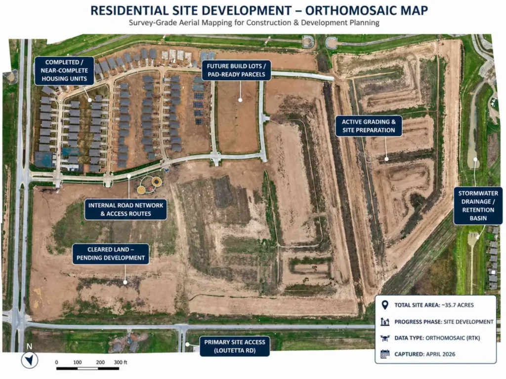

We provide high-resolution orthomosaic maps that can be imported directly into CAD and project management platforms like Procore or others
Most teams use this for quick site checks instead of waiting on survey updates—the accuracy is down to centimeters.
Routine drone flights capture high-resolution aerial imagery and geospatial data, giving project managers and stakeholders real-time visibility into construction progress from any location.
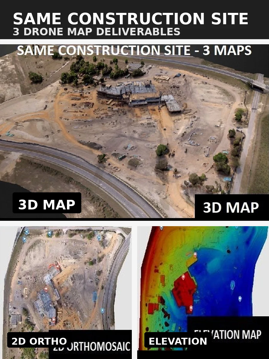
Our drone mapping services include orthomosaic maps, 3D site models, and detailed aerial photos that create an accurate record of site development over time. This consistent data capture helps identify delays early, reduce rework, and keep projects aligned with construction schedules.
Our construction drone services deliver survey-grade mapping outputs, including orthomosaic maps, digital surface models (DSM), and point clouds that integrate directly with CAD, BIM, and project management platforms.
These datasets support earthwork tracking, cut-and-fill analysis, and volumetric measurements with centimeter-level accuracy. Progress reports can be compared against design plans and previous flights, giving teams clear documentation of work completed and changes over time.
Drone-based construction monitoring reduces the need for personnel to access hazardous or hard-to-reach areas, improving overall site safety.
By replacing manual surveys and site walks, drone data collection lowers labor costs, accelerates timelines, and increases efficiency. Early issue detection through aerial inspections helps prevent costly delays, keeping projects on schedule and within budget.