Corpus Christi Drone Services


Professional Drone Services of Texas is proud to offer FAA-Approved, Fully Insured Competitively priced service to Corpus and the greater South Texas area.
Our services include
From commercial real estate and roofing inspections to offshore platforms and complex construction projects, we deliver the aerial intelligence South Texas industries depend on.
From crystal-clear aerial video to advanced thermal inspections, we deliver the data you need to see what others can’t.
Contact us to schedule your project. We offer rapid deployment and emergency response services when timing matters most.
We are ready for launch! We respond to most contact requests in a few hours! Submit a contact request or just drop us a line!
Our FAA-certified and insured team provides professional drone services across Texas, including aerial mapping, thermal inspections, construction progress monitoring, and high-resolution aerial photography and videography. We deliver accurate, reliable data with fast turnaround times for commercial, industrial, and energy sector projects.
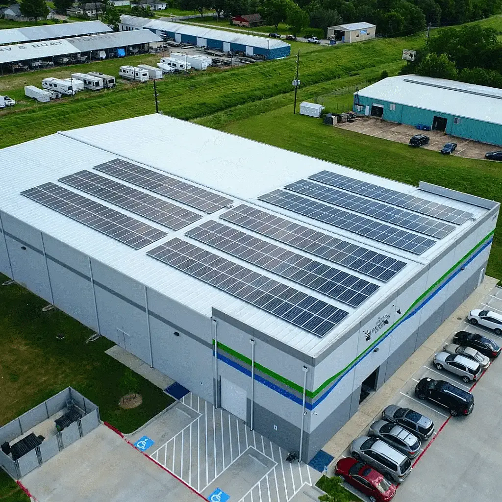
Using high-resolution drone mapping, 2D orthomosaics, and 3D models, we deliver safer, faster, and more accurate roof inspections and measurements. Our FAA-certified team provides thermal imaging, aerial inspections, and detailed reporting for roofing, solar, and insurance applications—helping reduce risk, improve documentation, and support better decision-making.
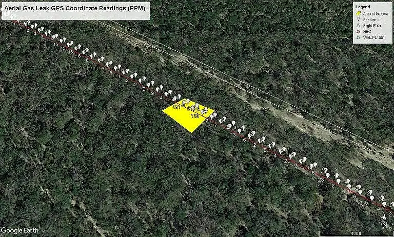
Professional Drone Services of Texas provides advanced unmanned aerial gas leak detection using optical gas imaging (OGI) technology to detect, locate, and quantify methane leaks. Our drone-based inspections support oil and gas operations, including well sites, gathering systems, and transmission and distribution pipelines—delivering accurate, safe, and cost-effective data for leak detection and emissions monitoring programs.
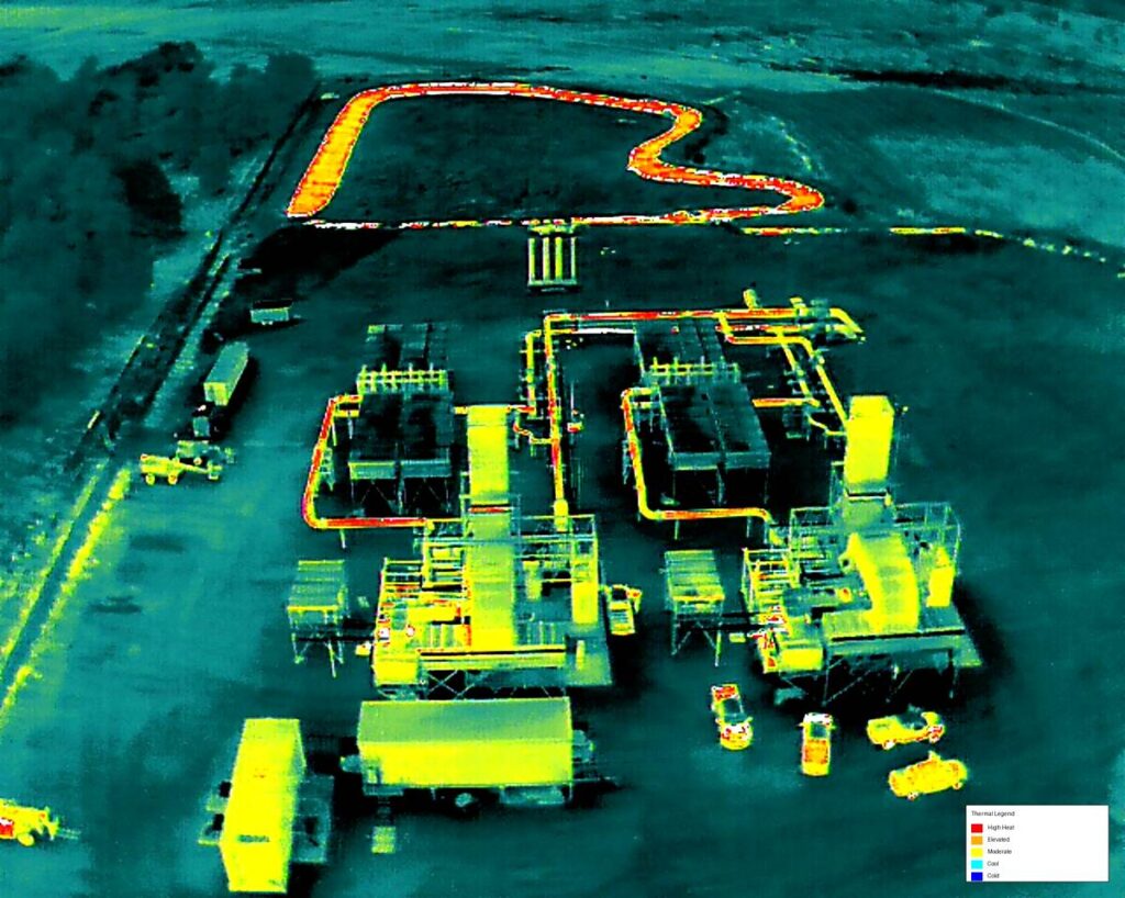
Our drone thermal imaging services detect hidden moisture, heat loss, and energy inefficiencies in residential and commercial structures. Using high-resolution infrared cameras, we provide accurate roof inspections, building diagnostics, and energy assessments. Combined with ground-based thermal imaging, our aerial inspections deliver a complete view of problem areas for faster, more informed decision-making.
Our drone photogrammetry services deliver high-resolution aerial mapping, 2D orthomosaics, and 3D models for construction, mining, and agricultural sites. Using advanced aerial mapping software, we provide accurate measurements and on-demand data to support planning, progress tracking, and site analysis—faster and more detailed than traditional satellite or manned aircraft methods.