

Drone Thermal Imaging Services in Houston, TX

Professional Drone Services of Texas provides commercial drone thermal imaging services in  Houston, TX, for electrical, energy, roofing, and industrial assets. Our FAA-certified pilots fly radiometric thermal cameras that read temperature across your equipment and structures, so you can spot overheating connections, wet roof insulation, and hidden energy loss from the air before any of it turns into a fire risk or an unplanned shutdown.

WHAT CAN WE DO FOR YOU?

Check Out Our Services in Houston, TX

Thermal imaging shows you what a standard walkthrough goes right past: the breaker running hot, the flat roof holding water, the motor about to seize. We fly infrared surveys for electrical systems, commercial roofs, mechanical equipment, and energy infrastructure across Houston, and hand you clear temperature data you can pass straight to your maintenance or engineering team.

Drone Inspection

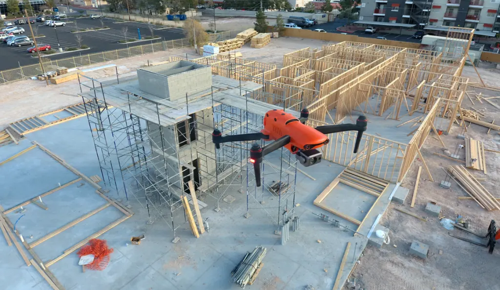
Beyond thermal, we run full visual drone inspections of roofs, towers, tanks, and other structures that are slow or risky to reach on foot. Our high-resolution optical cameras capture every hairline crack or rust spot, giving you detailed imagery of every problem area so your team can plan repairs early instead of finding out the hard way.

Drone Aerial Photography

Drone Aerial Photography Services

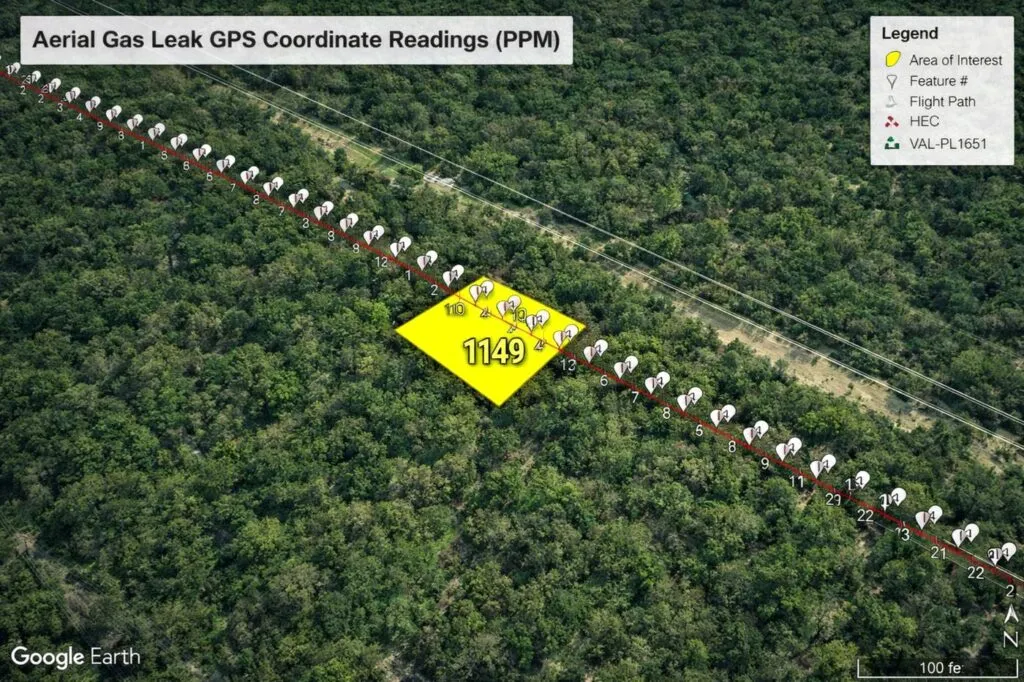
Our professional Drone Aerial Photography provides high-resolution imagery for Houston commercial, industrial, and construction sites. These detailed aerial views help teams document conditions, update stakeholders, and improve project reporting with clarity that standard ground-level photos cannot match. It’s the most efficient way to capture your project’s full scope from above.

Drone Thermal Imaging

Drone Thermal Imaging Services in Houston

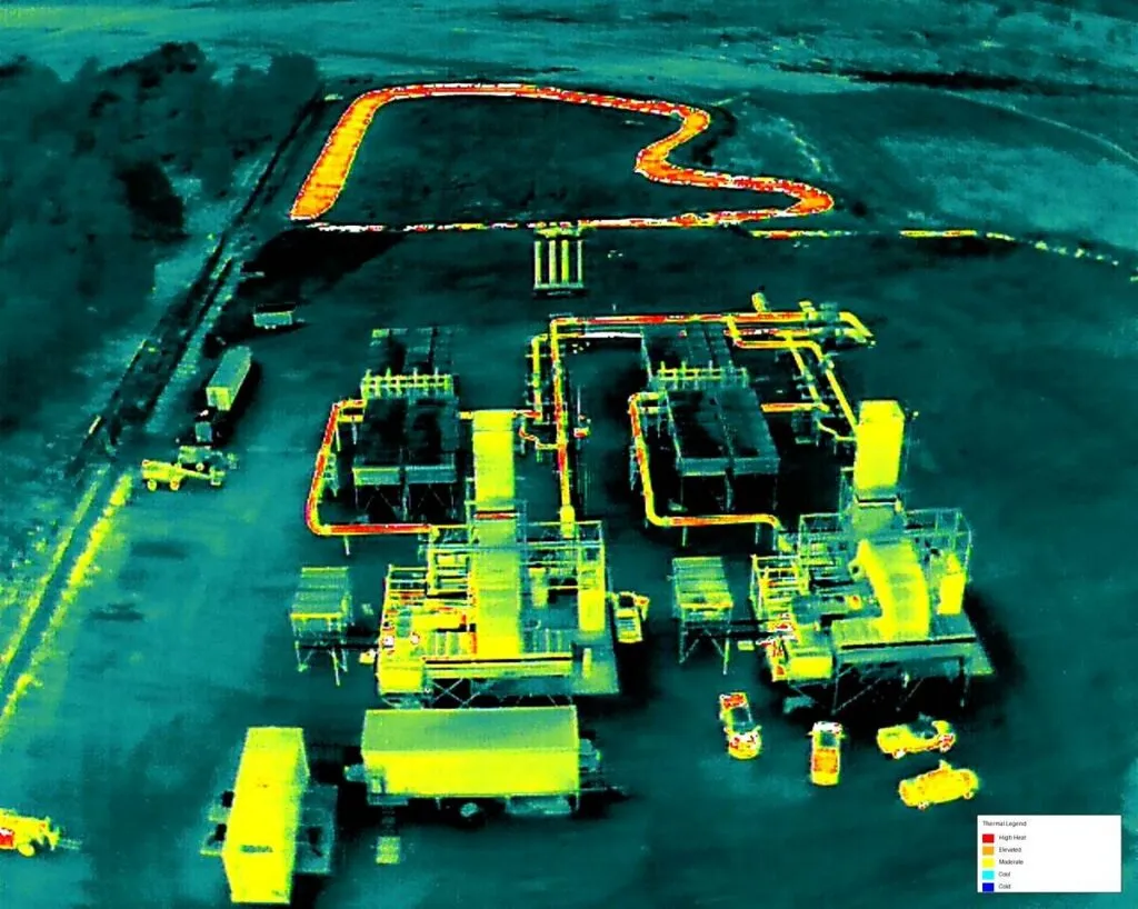
Drone Thermal Imaging is our core specialty. Our radiometric thermal drones detect heat anomalies, failing electrical and mechanical equipment, moisture trapped under roofing, and energy loss across building envelopes. For commercial, industrial, electrical, and infrastructure sites around Houston, it’s the fastest way to catch a problem while it’s still just a warm spot on the screen.

Drone Mapping & Photogrammetry

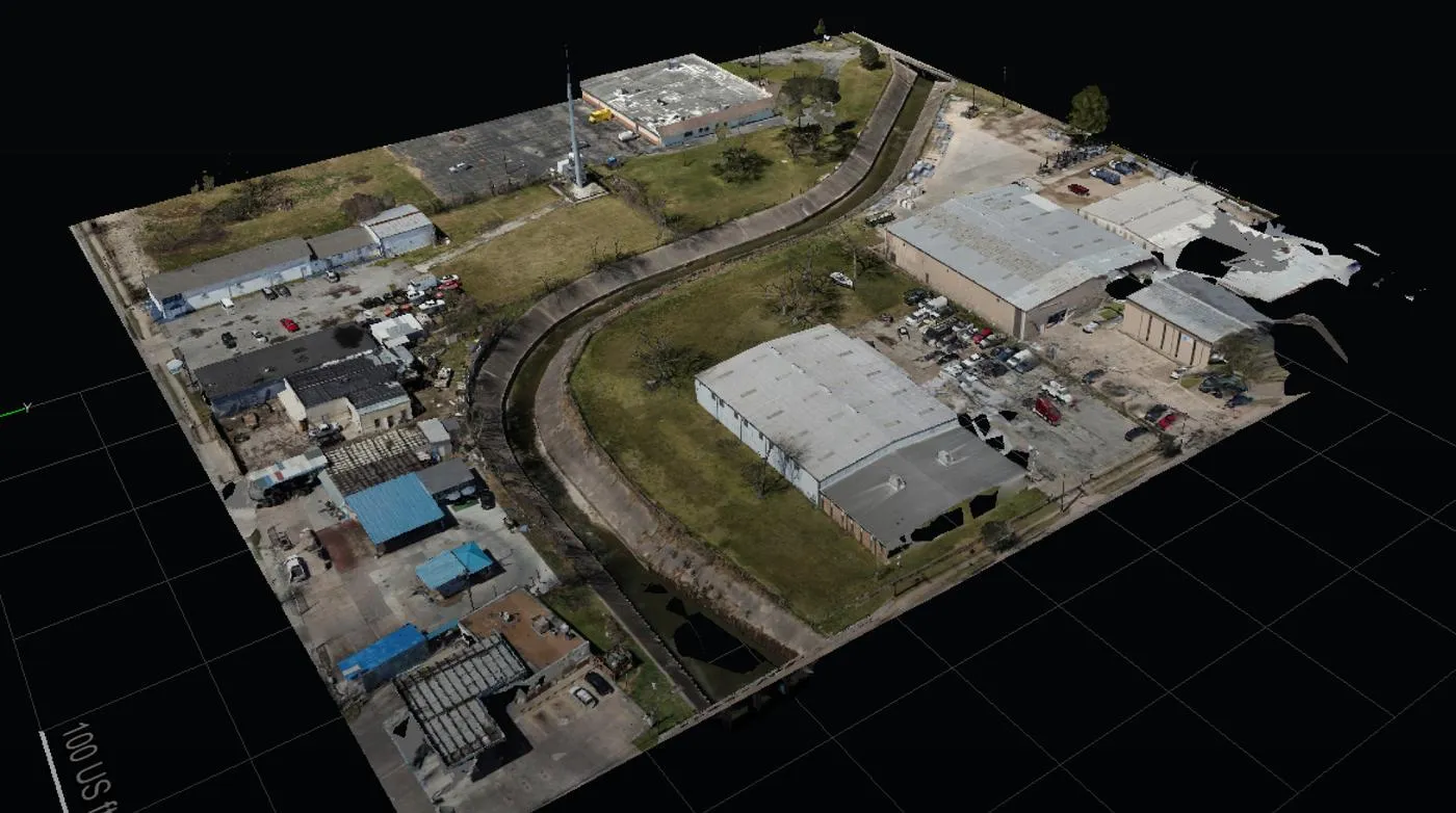
Drone Mapping & Photogrammetry provides precise, survey-grade measurements via advanced aerial data. We generate detailed 3D models and CAD-ready deliverables that support critical project workflows. Engineering and construction teams rely on these high-fidelity insights for accurate site planning, efficient land surveys, and precise volume calculations on complex, large-scale developments.

LEARN MORE ABOUT US

Who are we?

Professional Drone Services of Texas is a Houston-based commercial drone company. We work with electrical, energy, roofing, and industrial teams across the metro area, flying to FAA commercial standards and specializing in thermal work, so the temperature data you collect on a substation, a solar array, or a 200,000-square-foot roof is accurate enough to act on with confidence.

Our Key Deliverables:

Why Choose Professional Drone Services of Texas

Reasons to Trust

Our FAA-certified pilots fly the thermal survey and read the imagery themselves, so hot spots get flagged by someone who knows what they mean.

Your Best Choice

We run radiometric cameras that give real temperature values, not just color pictures, so your team can prioritize by how hot a problem actually is.

Right Choice for You

We work with facility, electrical, and roofing pros who need thermal data solid enough to schedule real repairs and back up a maintenance call.

Professional

From switchgear to flat roofs, we plan each flight for clean thermal capture and deliver imagery clear enough for engineering and maintenance use.

Google Review

Write a Review

Top Rated Drone Thermal Imaging Services in Houston, TX

Houston facility and maintenance teams come back to us for thermal work because the findings hold up: a flagged connection that really was overheating, a roof leak caught before the ceiling showed it. From electrical surveys to full commercial roof moisture scans, we give industrial and commercial clients infrared data solid enough to spend a repair budget on.

Check Out Our Gallery

Proudly Serving Houston, TX & The Texas Gulf Coast

Houston is a sprawling, hard-working region, and so are the teams that keep it running. Professional Drone Services of Texas is based right here and flies throughout the metro and along the Texas Gulf Coast, from the Ship Channel and Pasadena to Baytown, Katy, Sugar Land, and The Woodlands. We also head south to Texas City and Galveston, and east toward Beaumont when a project calls for it. Local crews mean quicker scheduling, familiarity with Gulf weather, and pilots who know the area’s plants, warehouses, and rooftops. Wherever your site sits along the coast, call (832) 856-8556 and we’ll talk through your timeline and site access.

Call Us Now

Got equipment running hot or a roof you suspect is holding water? Contact Professional Drone Services of Texas and tell us what you need scanned: electrical, mechanical, roofing, or a full facility. We’ll go over the site, the right time of day to fly it, and what the thermal data has to show, then send a clear quote. Call (832) 856-8556 to get scheduled.

Frequently Asked Questions

What are drone thermal imaging services in Houston, TX?
Drone thermal imaging uses radiometric infrared cameras on a UAV to measure surface temperature across roofs, electrical equipment, and industrial assets. Our FAA-certified pilots capture heat data from above, so Houston facility teams can spot hidden problems without shutdowns, lifts, or scaffolding.
Thermal drones reveal overheating electrical connections, failing motors, moisture trapped beneath roofing, insulation gaps, and energy loss across building envelopes. These heat patterns are invisible to the naked eye, so you can schedule repairs early instead of reacting to an outage, leak, or fire risk.
We fly radiometric cameras that record actual temperature values, not just colored images. With careful flight planning and pilots trained to read the data, results are reliable enough to prioritize repairs and support maintenance or engineering decisions with confidence.
For large or hard-to-reach assets, usually yes. A drone can scan a 200,000-square-foot roof or a solar array in a fraction of the time, with no one walking on fragile surfaces or climbing structures. Handheld cameras still suit tight interiors, so we’ll recommend the right method.
How much do drone thermal imaging services cost in Houston?
Pricing depends on site size, asset type, access, and deliverables. A single roof scan costs less than a multi-building electrical survey. Call (832) 856-8556 with your property details, and we’ll review what needs scanning and send a clear quote.
Roof moisture scans work best in the evening, a few hours after sunset, when wet insulation holds heat longer than dry areas. Electrical surveys run best while equipment is under normal load. Houston’s humidity and weather affect timing, so we plan each flight around conditions.
You get a thermal inspection report with annotated infrared and visible images, temperature readings, and flagged problem areas ranked by severity. Each finding includes a location reference, so your electrical, roofing, or maintenance crew can find the issue fast and plan the repair.
No. Thermal drone surveys are non-contact, so equipment stays energized and running. Electrical components actually need to be under load to show heat problems. We coordinate access and safety with your team, then fly without interrupting production or tenant operations.

CONTACT US

You Can Contact Us Any Time

Request a Quote