Aerial Gas Leak Detection

A drone on a table with aerial images of land and infrastructure.

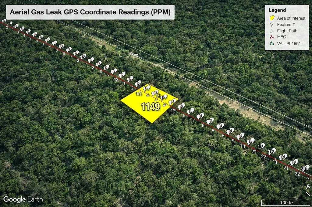
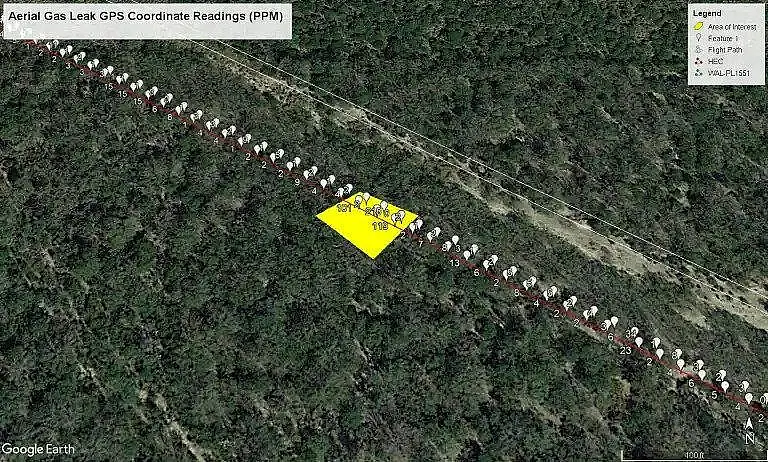
Professional Drone Services of Texas provides Unmanned Aerial Gas Leak Detection services that consistently sense, trace, and measure methane leaks. From gas producing wells and gathering lines to transmission and distribution pipelines, PDS provides accurate data that is delivered safely, efficiently, and cost-effective to your leak detection programs.
PDS utilizes the TDLAS (Tunable Diode Laser Absorption Spectrometer) equipped under a Small Unmanned Aircraft System. The TDLAS is an innovative long-range detector which allows methane gas (CH4) to be detected at distances of up to 50 Meters at as little volume as 1 pmm.m. Methane leaks are located by pointing the Laser Beam to the suspected leak, or along the survey line. The TDLAS detects Methane by emitting infrared light allowing the examination of reflected light density. Each Laser Spectrometer reading has stored GPS Coordinates that are accurate by 1-2 Centimeters.

Upon receiving an accurate KMZ/KML File of the Pipeline Data, PDS can import each of these segments to our Flight Planning software allowing the Small Unmanned Aircraft to autonomously survey the Pipeline Segment. PDS then processes and organizes the Data then delivers each Flight Segment in a KML File allowing the user to view each Spectrometer Reading by their plotted GPS Coordinate on Google Earth.

Aerial map showing gas leak GPS readings over forest area with highlighted zone of interest.

Aerial Gas Leak Detection Services

Pipeline, facility, and waste-management operators are under increasing pressure to identify methane emissions quickly, accurately, and with defensible documentation. Our aerial gas leak detection program provides a modern, high-efficiency solution by deploying a drone-mounted TDLAS methane sensor along precisely planned autonomous flight paths. This approach allows us to map methane signatures across long pipeline corridors, waste facilities, industrial complexes, and remote areas where ground access is difficult or unsafe. By gathering continuous methane readings from above, we significantly reduce inspection time while providing clear, actionable data that operators can use immediately.

Drone Photo

How Our Detection Method Works

Our detection workflow is built around a highly sensitive TDLAS (Tunable Diode Laser Absorption Spectroscopy) sensor mounted beneath a professional-grade drone platform. The sensor continuously measures methane concentration along the aircraft’s autonomous mission route, allowing us to capture a complete corridor-wide methane profile in a single flight.

KMZ Leak Map Example

Autonomous Mission Planning & Alignment

One of the most critical advantages of our method is the use of autonomous waypoint missions generated directly from the survey files provided by the client. Whether we’re inspecting a pipeline centerline, a gathering system, a waste processing boundary, or a facility perimeter, the drone’s route is built to match the exact geometry of the asset. This ensures consistent coverage, precise spatial alignment, repeatable survey paths, and smooth, stable sensor orientation for clean, defensible methane data.

Interpreting Methane Signals

Each methane anomaly is automatically logged, geolocated, and displayed in the KMZ/KML deliverables. In Google Earth or a comparable viewer, elevated points appear as pinned markers with their associated concentration values. Operators can zoom into individual points, scan the full corridor, and overlay readings against satellite imagery, vegetation, topography, culverts, and facility structures. Clusters of readings form clear visual patterns that highlight areas needing ground confirmation and maintenance prioritization.

Data Processing & Seamless Delivery

Once the flight is complete, the methane data is processed and transformed into a clean deliverable package. All final outputs—including KMZ/KML files, SHP and GeoJSON layers, CSV tables, a photographic map, and a narrative summary report—are packaged into a single ZIP archive. Clients can instantly open the KMZ for review, upload GIS layers into their systems, or assign work orders based on GPS coordinates. Our process eliminates friction and removes the need for special software or configuration.

Deliverables

(Personal Methane Report)

Photographic Map with links to downloadable files

List of Top 10 highest PPM-M Readings, an image and their coordinates.

Case Study: Pipeline Corridor Survey

A recent inspection demonstrates the efficiency and precision of this method. The mission followed an autonomous flight plan derived directly from the provided centerline GIS data. Thousands of elevated methane points were identified across the corridor, each recorded with detailed geolocation and timestamps. The resulting KMZ, CSV, GIS layers, and summary report enabled immediate action. Field crews were dispatched directly to exact coordinates without requiring additional scouting or repeated inspections.

Why This Method Saves Time, Money & Improves Safety

Aerial methane detection dramatically increases efficiency by allowing long stretches of pipeline or broad facility areas to be inspected far faster than is possible on foot. Only the locations showing elevated readings require on-the-ground confirmation, reducing labor, truck mileage, and repeated visits. Safety improves as crews avoid difficult terrain, dense vegetation, and hazardous industrial zones. Methane readings are time-stamped, geotagged, and archived for compliance documentation.

A Streamlined Experience from Start to Finish

From mission planning to data delivery, our workflow is designed to minimize friction. After receiving the survey files, we generate the autonomous mission, perform the inspection, process the data, and deliver a unified ZIP file containing every output. Clients can upload the GIS layers, review methane hotspots, and dispatch technicians the same day.
Request a Quote