Drone Aerial Photography Services in San Antonio, TX

Professional Drone Services of Texas provides expert commercial drone mapping, engineering support, and asset inspection across San Antonio. We specialize in construction progress documentation, precise thermal reports, and high-quality CAD-ready deliverables. Our team serves industrial clients, ensuring your local engineering and infrastructure projects get accurate field data.

Industries We Support

Commercial Drone Mapping
Asset Inspection
Construction
Engineering
Energy

Survey Support

WHAT CAN WE DO FOR YOU?

Check Out Our Services

We offer specialized industrial drone solutions built for the energy, construction, and engineering industries. Moving beyond basic visuals, our services highlight critical areas like structural asset inspection, infrastructure mapping, and thermal imaging. We supply the high-density point clouds and executive reports needed for fast project decisions.

Drone Inspection
Drone methane gas leak detection along oil and gas pipeline using aerial mapping and GPS data

Our professional asset inspection keeps your industrial teams safe while tracking infrastructure health. We scan large structures to find hidden damage, provide deep engineering reports, and help contractors lower on-site maintenance costs.

Drone Aerial Photography

We deliver highly detailed site overviews purely for construction monitoring and industrial progress tracking. Our skilled team provides clear site data and executive reports built specifically for engineers, contractors, and project stakeholders.

Drone Thermal Imaging

Our advanced thermal imaging scans energy infrastructure to locate heat anomalies, leaks, and defects early. We deliver clear thermal reports to help engineering teams protect valuable machinery and maintain safe operations.

Drone Mapping & Photogrammetry
Drone surveying and 3D mapping for infrastructure and land development showing aerial site model and construction layout

We build accurate commercial drone mapping and photogrammetry models for industrial survey support. Our technicians generate high-density point clouds, professional orthomosaics, and detailed CAD-ready deliverables to streamline your design workflow.

LEARN MORE ABOUT US

Who are we?

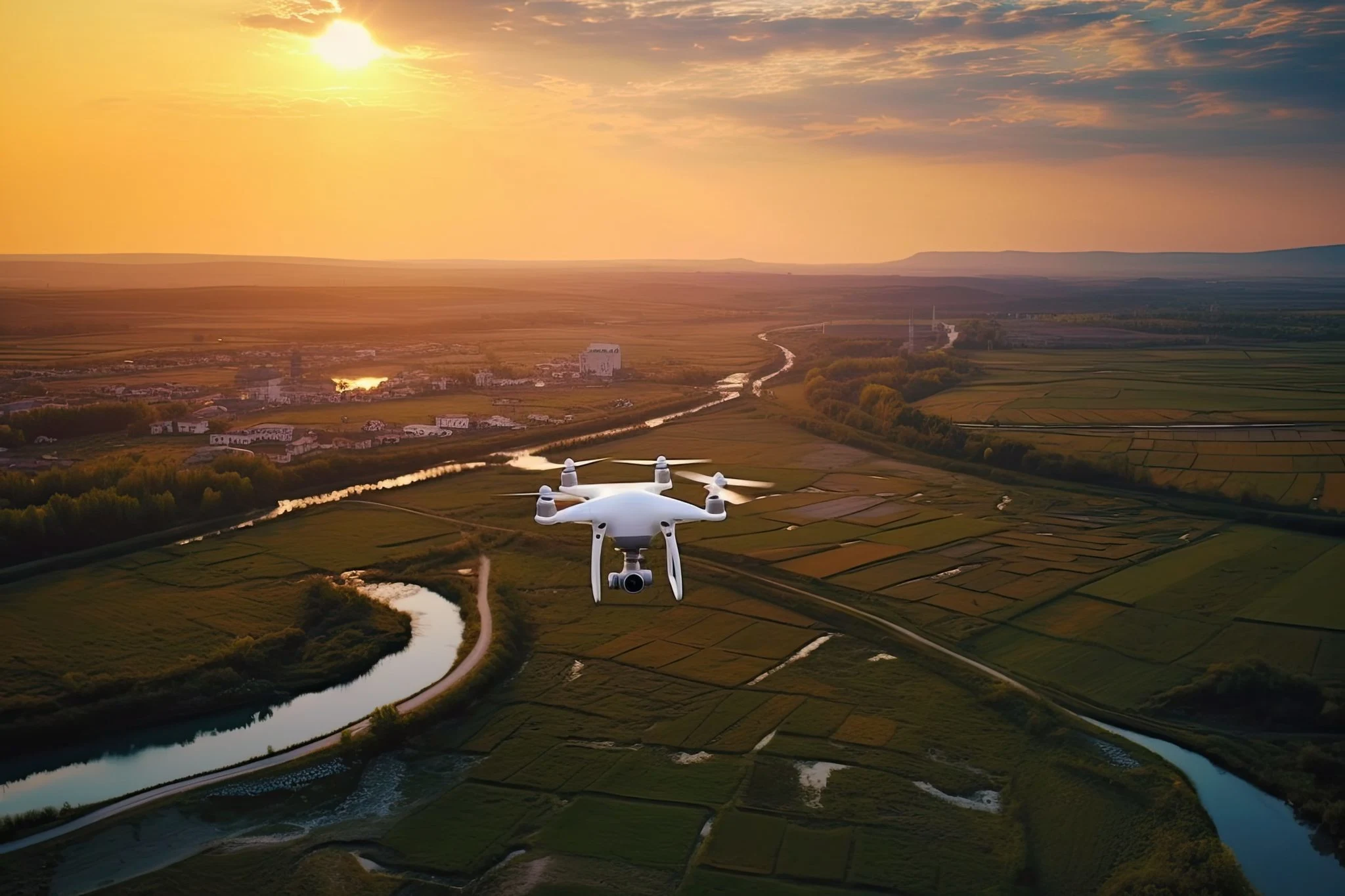
We provide professional commercial dron

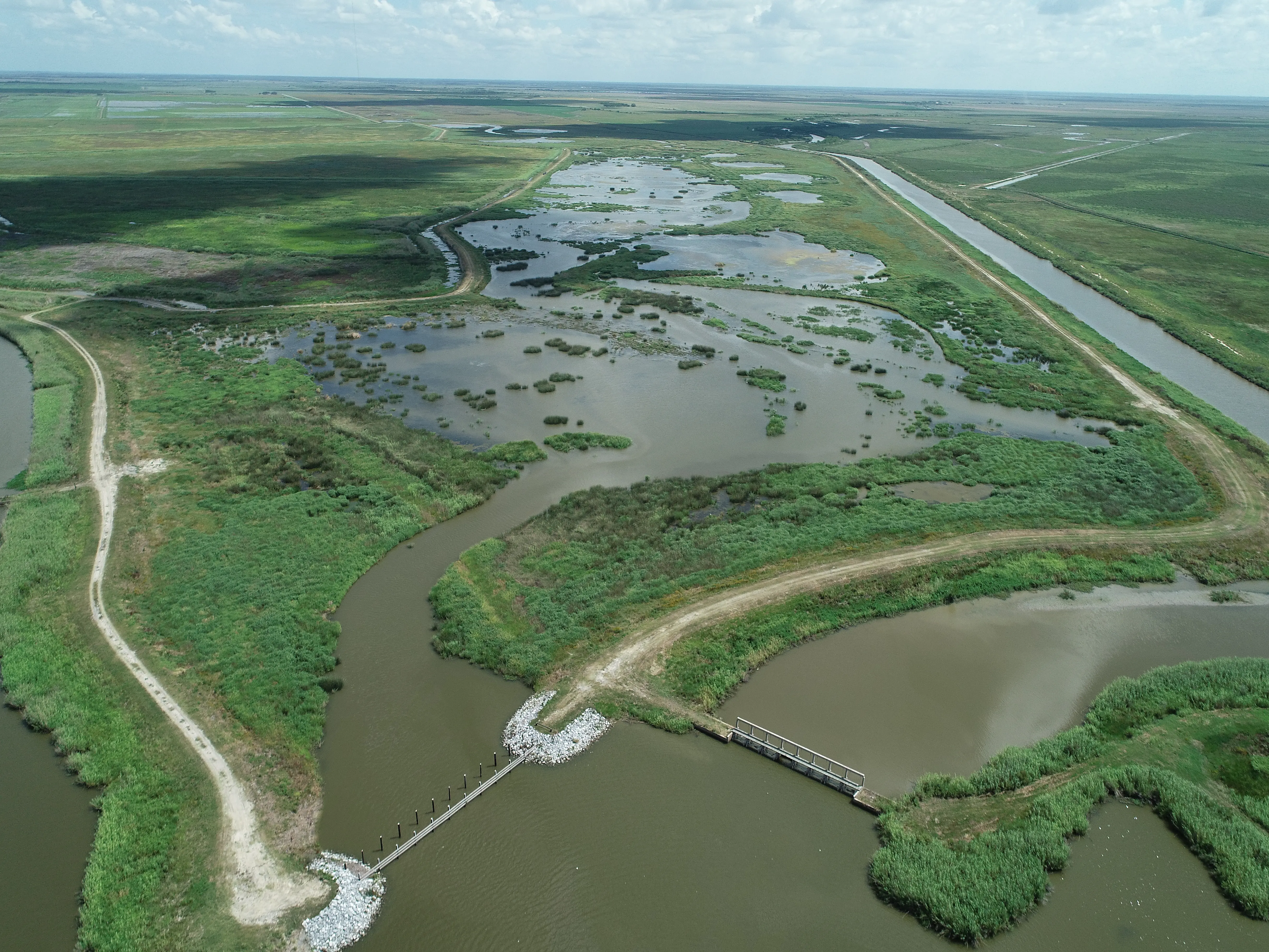
Professional Drone Services of Texas is a leading B2B industrial data company. We go beyond basic drone flights to deliver high-tier engineering, construction, and infrastructure data for major commercial projects.

Our company partners directly with civil engineers, site managers, and general contractors. We focus on producing precise orthomosaics, point clouds, and executive reports to ensure your field operations run smoothly.

e solutions for engineering, construction, energy, and industrial sectors, delivering accurate aerial data for smarter planning and project execution.

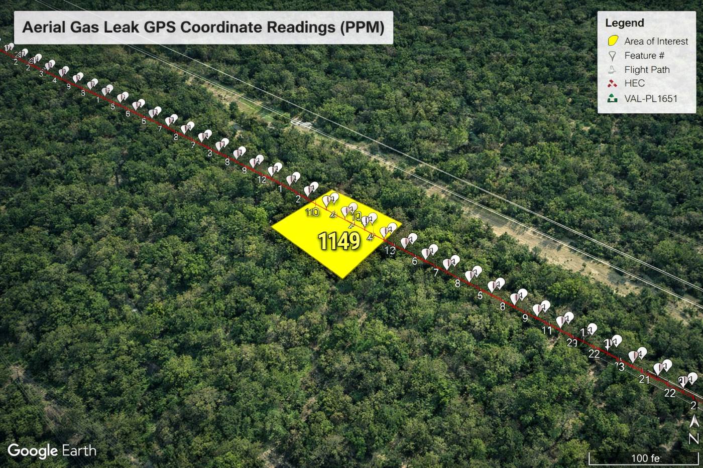
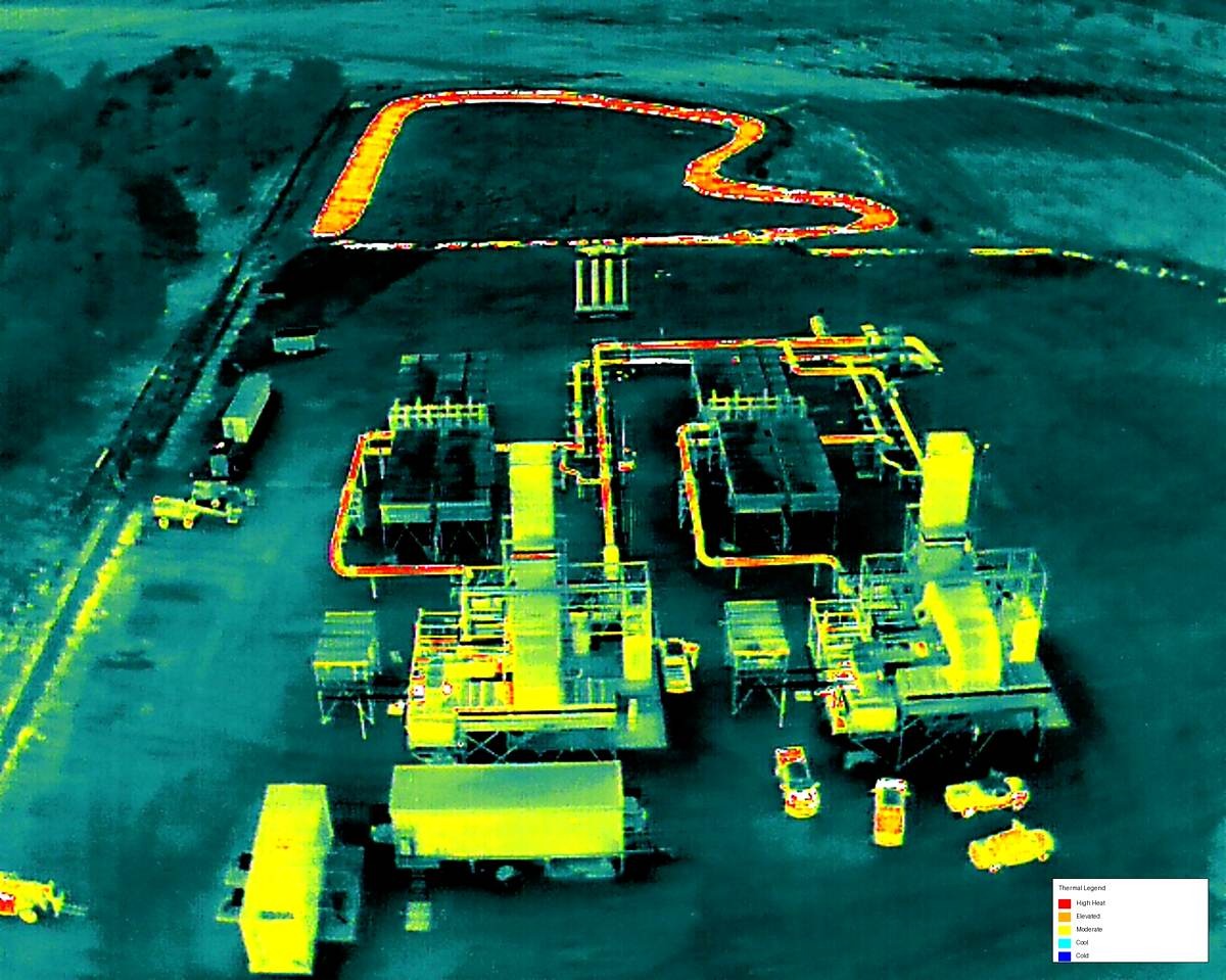
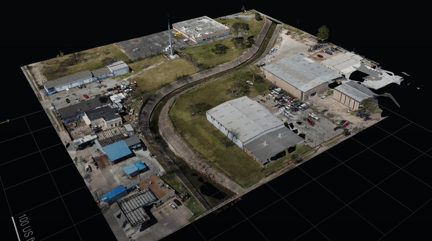
Our team specializes in drone inspections, mapping, thermal imaging, orthomosaics, point clouds, and CAD-ready deliverables that support informed decisions, operational efficiency, and infrastructure management.

Why Choose Professional Drone Services of Texas

Reasons to Trust

We dedication ourselves entirely to infrastructure, energy, and construction mapping. Our experienced team guarantees strict field safety, expert compliance, and highly accurate technical data.

Your Best Choice

We supply valuable point clouds, thermal data, and CAD-ready deliverables. Our advanced mapping tools help industrial project managers reduce risk, save time, and control budgets.

Right Choice for You

We customize our asset inspection and commercial drone mapping for your industrial site. Receive the exact construction progress documentation and technical reports your engineering team needs.

Professional

Our certified crew operates specialized drone sensors to capture raw field assets. We emphasize industrial-grade quality, commercial standards, and highly reliable technical reports for companies.

Google Review

Write a Review

Top Rated Drone Aerial Photography Services in San Antonio, TX

We deliver top-tier commercial mapping, engineering support, and construction monitoring throughout San Antonio. Our team supplies professional orthomosaics, clean point clouds, and technical thermal reports, making us the premier partner for demanding industrial operations.

Check Out Our Gallery

Aerial drone inspection of offshore oil rig supporting energy infrastructure monitoring and maintenance operations

Call Us Now

Need high-quality deliverables like point clouds, orthomosaics, and CAD-ready files? Reach out to Professional Drone Services of Texas today for reliable commercial drone mapping and advanced industrial asset inspection on your next construction project.

CONTACT US

You Can Contact Us Any Time

    Request a Quote