Construction is one of the most critical industries, and its success relies on the management team’s efficiency. Drone technology has...
Read More
Blog
Drone Thermal Imaging Services: A Cost-Effective Solution For Detecting Water Leaks
Water leaks can cause significant damage to properties and are often costly to repair. Detecting water leaks early on is...
Read More
Drone Aerial Photography for Business: How It Can Benefit Your Marketing Strategy
In today’s competitive business world, marketing is a crucial element that can make or break a company’s success. With the...
Read More
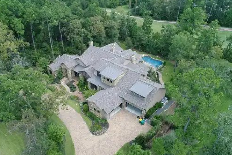
How Drone Aerial Photography Adds a Wow Factor to Your Special Events
Special events are all about creating lasting memories and preserving those cherished moments that hold a special place in our...
Read More
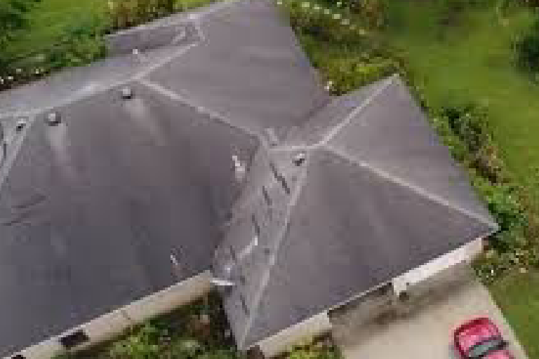
What Key Challenges Do Drones Overcome in Commercial Roof Inspections?
In today’s rapidly evolving world, technological advancements have revolutionized industries across the board, and the field of roof inspections is...
Read More
Tired of Non-Effective Marketing? How Can Drone Aerial Photography Breathe Life into Your Business Strategies?
In the ever-evolving landscape of business marketing, staying ahead of the curve is paramount. If you’re tired of your marketing...
Read More
How Do Drones with Thermal Imaging Assist in Public Safety and Law Enforcement?
The role of technology in enhancing public safety and law enforcement cannot be underestimated in today’s fast-paced world. Among the...
Read More
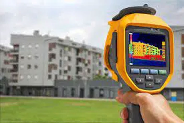
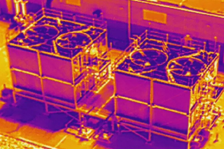
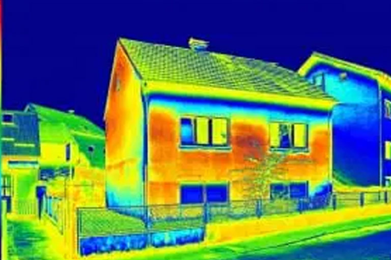
Aging Infrastructure Got You Down? Revitalize Your Operations with Drone Thermal Imaging Services
Have you ever looked at your building and wondered about the hidden issues lurking beneath the surface? Aging infrastructure can...
Read More
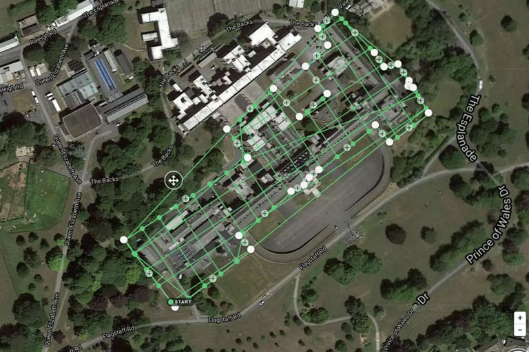
Why Should Your Business Embrace Drone 3D Mapping Services for Enhanced Insights?
In a world where technology is revolutionizing every facet of our lives, it’s no surprise that even the way we...
Read More
JOHN BONNER
Wayne has done a great job photographing my residential development. I recommend his services.
Read More
LUANNE WONDERS
Positive: Professionalism , Quality , Responsiveness , Value Wayne was very helpful and so easy to work with! Fine-tuned their...
Read More
ADAM SUTLIFF
I am so happy to have found Wayne and is Professional Drone Services team. As a landscape architect working on...
Read More
JEROMY GENSCH
Positive: Professionalism , Quality , Responsiveness , Value Wayne and the team at Pro Drone Services of Texas provided exceptional...
Read More
JAMES HURLEY
Little more than 24 hrs after my initial website inquiry, I was meeting with the pilot (James D.) at my...
Read More
AERIAL1 IMAGING THAT GOES ABOVE & BEYOND
Lorem ipsum dolor sit amet consectetur adipisicing anim elit dolore magna aliqua veniam quis nostrud.
Read More
AERIAL IMAGING THAT GOES ABOVE & BEYOND
Lorem ipsum dolor sit amet consectetur adipisicing anim elit dolore magna aliqua veniam quis nostrud.
Read More
Hello world!
Welcome to WordPress. This is your first post. Edit or delete it, then start writing!
Read More