Drone mapping vs total station: compare accuracy, speed, cost, and field use cases to choose the right data capture method...
Read More
How Do You Verify Methane Emissions?
Learn how to verify methane emissions with practical methods, field data, and inspection workflows that support compliance and better asset...
Read More
How Accurate Are Drone Surveys?
How accurate are drone surveys? Learn what affects precision, when survey-grade results are realistic, and where limits still matter most.
Read More
Can Texas Aerial Pipeline Inspections Scale?
Texas aerial pipeline inspections help operators reduce field risk, document conditions faster, and capture decision-grade data across long assets.
Read More
Can You Use A Drone During An Inspection For An Insurance Claim?
Drone inspection for insurance claims gives insurers faster, safer, decision-grade site data for damage review, documentation, and settlement accuracy.
Read More
How Accurate is Drone Mapping?
Learn how to verify drone mapping accuracy using checkpoints, GCPs, RMSE, and field validation to confirm decision-grade survey data.
Read More
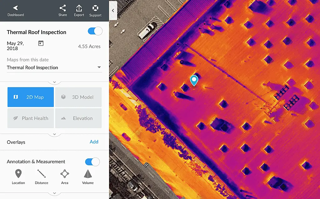
Which Is Best For Your Site? Thermal Imaging Or Visual Inspection?
Compare thermal imaging vs visual inspection for roofs, utilities, and sites. Learn where each method works best and when both...
Read More
Can Drones Detect Methane Gas Leaks Reliably?
Can drones detect gas leaks reliably? Learn how methane detection drones work, where they perform best, and what limits matter...
Read More
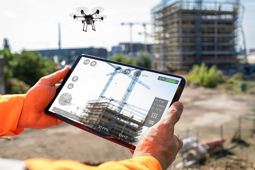
What Is A Commercial Drone Inspection?
A commercial drone inspection guide for construction, energy, and infrastructure teams focused on safer access, faster data, and accuracy.
Read More
Which Is Best Drone LiDAR Or Photogrammetry?
Drone LiDAR vs photogrammetry: compare accuracy, speed, cost, and site fit to choose the right aerial mapping method for commercial...
Read More
Can You Map A Pipeline Right of Way With A Drone?
Pipeline right of way mapping gives operators accurate corridor data for compliance, planning, inspections, and faster field decisions.
Read More

Does A Drone Do Volumetric Stockpile Measurements?
Drone volumetric stockpile measurement delivers fast, repeatable inventory data for mines, quarries, and job sites with less field time.
Read More
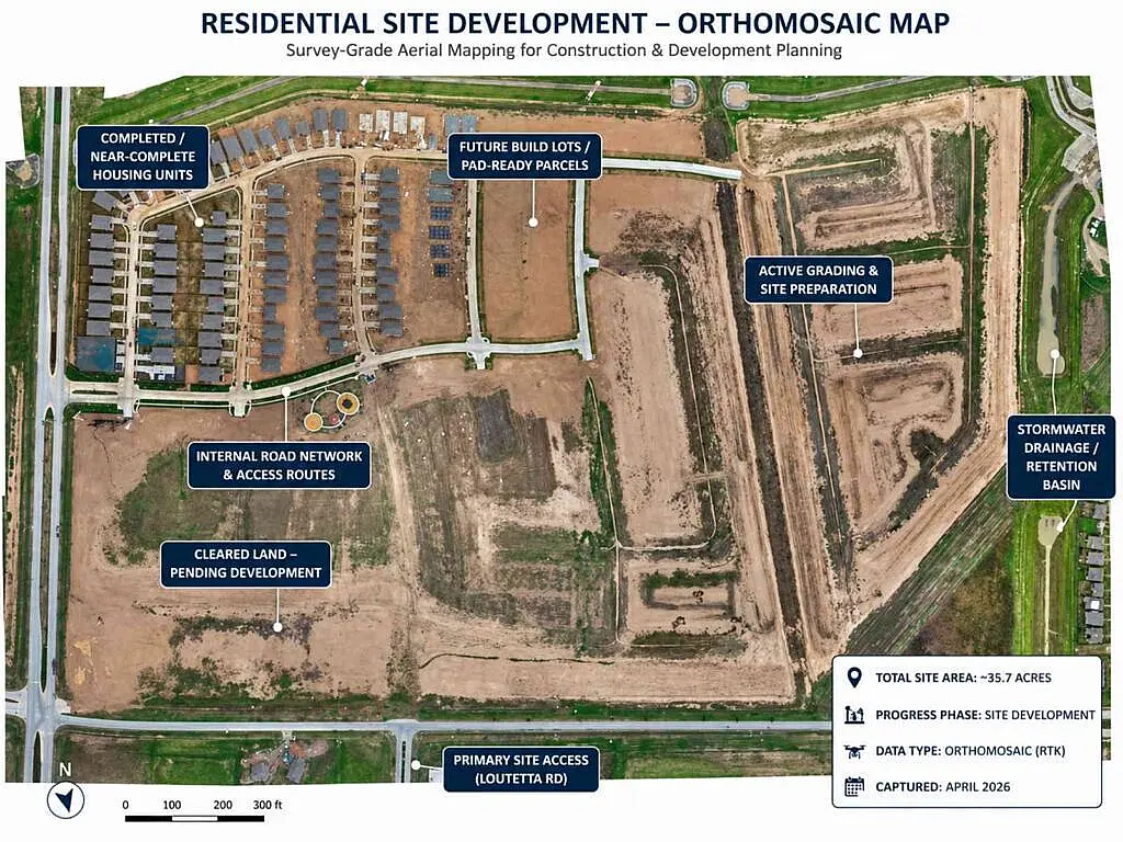
What Are The Uses For Construction Drone Orthomosaics?
Learn how a construction drone orthomosaic map improves site visibility, tracking, and decisions with accurate, current aerial data.
Read More
What Do Aerial Data Capture Services Deliver?
Aerial data capture services provide decision-grade imagery, mapping, and inspections that improve safety, speed, and accuracy on commercial sites.
Read More

Why Use A Drone For Site Documentation Services?
Drone site documentation services give construction and asset teams faster visibility, accurate records, and decision-grade data.
Read More
Does Using A Drone Cut Cell Tower Drone Inspection Risk?
Cell tower drone inspection reduces climb risk, speeds reporting, and delivers decision-grade data for maintenance, compliance, and asset planning.
Read More
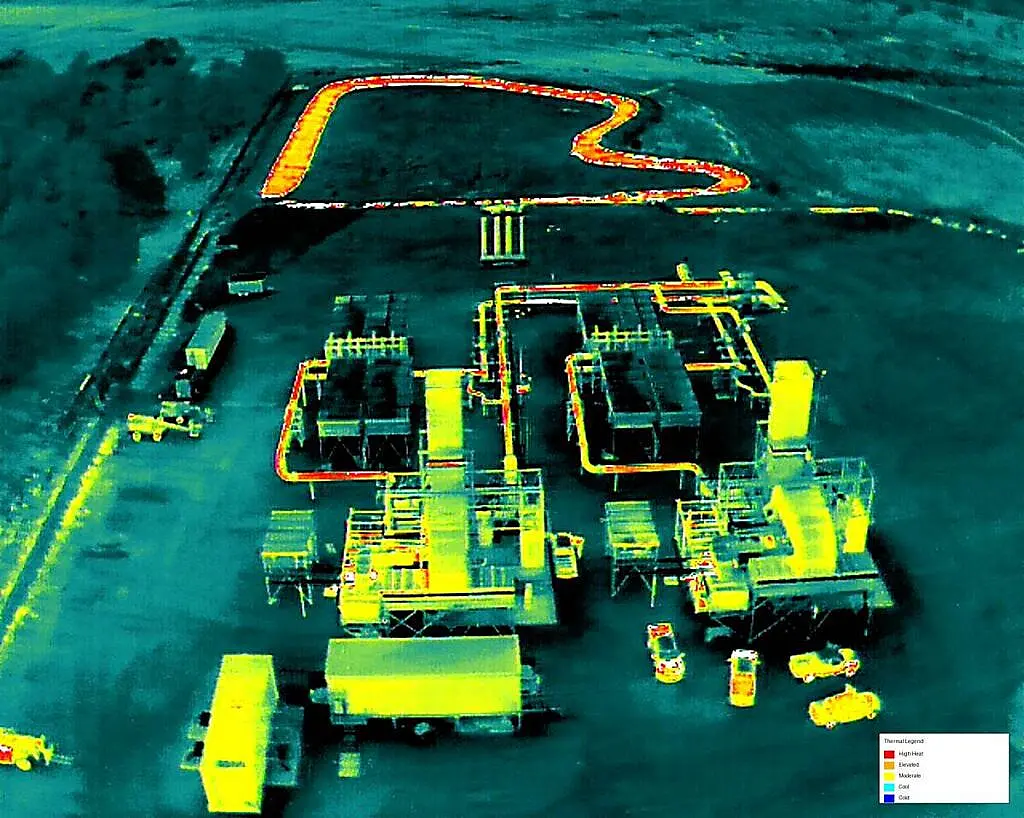
What Are Industrial Flare Inspection Drone Benefits?
See how an industrial flare inspection drone improves safety, speeds data capture, reduces downtime, and supports decision-grade maintenance planning.
Read More
How Does A Drone Company Inspect A Bridge?
Learn what to look for in a bridge drone inspection company, from FAA compliance and data quality to engineering-ready deliverables...
Read More
Do Drone Powerline Inspection Services Scale?
Drone powerline inspection services help utilities and contractors inspect faster, reduce risk, capture decision-grade data, and support compliance.
Read More
Do Drones Find Solar Farm Thermal Loses By Inspection?
Solar farm thermal inspection helps detect hot spots, string faults, and underperforming assets fast, with decision-grade data for field action.
Read More