What is a commercial drone inspection?
When a site issue sits 120 feet up a flare stack, across a live substation yard, or on a roof you cannot shut down, inspection speed stops being a convenience and starts affecting cost, safety, and schedule. A strong commercial drone inspection guide is not about flying for the sake of flying. It is about getting usable data from difficult environments without sending more people into unnecessary risk.
For commercial teams, that distinction matters. Drone inspections are valuable when the output supports a real decision – whether that means confirming structural wear, documenting construction progress, identifying thermal anomalies, checking a facade, or capturing visual evidence for compliance and insurance. If the deliverable does not help operations, maintenance, engineering, or management act quickly, the flight did not do enough.
What a commercial drone inspection guide should actually help you decide
Most buyers are not looking for aircraft details. They are trying to answer a simpler question: can this inspection method produce data my team can trust? The right standard is not whether a drone can reach the asset. It is whether the mission can be planned safely, executed legally, and delivered in a format that fits your workflow.
That is why inspection planning matters as much as capture quality. A roof survey for a commercial real estate owner has different requirements than a thermal scan of electrical equipment, a methane gas leak survey, or a bridge condition review. In one case, high-resolution imagery may be enough. In another, you may need radiometric thermal files, georeferenced orthomosaics, repeatable progress capture, or engineering-ready image sets tied to exact asset locations.
A practical commercial drone inspection guide should help you define scope before the first battery is charged. Start with the problem, not the aircraft. Ask what needs to be seen, measured, documented, or compared over time. That single shift prevents many of the most common failures in drone inspection work.
Where commercial drone inspections create the most value
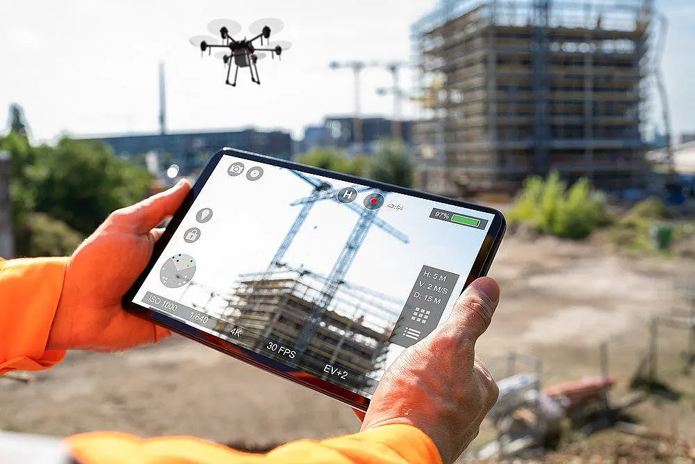
The strongest use cases tend to be the ones where manual access is expensive, slow, or disruptive. Construction teams use drone inspections to monitor vertical progress, verify installed conditions, document site logistics, and maintain a visual record that can be shared across stakeholders. On large sites, that can reduce time spent walking the project while improving visibility for owners and project managers.
In energy and industrial settings, the value often comes from risk reduction and speed. Elevated assets, remote corridors, tank farms, flare systems, pipelines, and process equipment can be assessed without putting personnel in lifts, on ropes, or in hazardous areas unless follow-up work is truly needed. Thermal imaging adds another layer by helping teams identify abnormal heat signatures tied to mechanical or electrical issues.
Infrastructure operators often need something slightly different – repeatable documentation. Bridges, drainage systems, utility structures, road corridors, and public assets benefit from inspections that can be repeated from consistent positions over time. That makes trend tracking more credible and helps teams prioritize maintenance instead of reacting late.
Commercial real estate owners and facility managers usually care about condition visibility, tenant-impact reduction, and documentation speed. Roof membranes, facades, parking structures, storm damage, and envelope issues can often be assessed faster from the air, especially when access constraints make traditional inspection inefficient.
What separates useful inspections from generic aerial footage
A lot of disappointment in this market comes from a mismatch between visuals and deliverables. Good-looking imagery is not the same thing as decision-grade data. If your team needs engineering input, insurance support, maintenance planning, or compliance documentation, the outputs must be structured for that purpose.
That may include annotated image sets, thermal reports, defect tagging, geolocated findings, 2D orthomosaics, 3D models, volumetric measurements, or side-by-side progress comparisons. The right deliverable depends on the asset and the decision being made. A single folder of unlabeled photos rarely solves much.
Flight execution also matters. Lighting conditions, oblique angles, standoff distance, thermal calibration, airspace restrictions, and site safety coordination all affect data quality. A provider that understands inspection operations will talk as much about mission planning, compliance, and output format as they do about equipment.
Safety, compliance, and airspace are part of the job
Commercial inspections do not happen in ideal conditions. Many take place near active job sites, highways, energized equipment, industrial processes, or controlled airspace. That means the flight plan has to fit the environment, not the other way around.
FAA compliance is the baseline, but the real question is whether the operator can manage the operational complexity of your site. Some projects require waivers, specific coordination procedures, visual observer support, site-specific hazard reviews, or tightly defined flight windows to avoid interfering with ongoing work. In active commercial environments, that discipline is what keeps the inspection efficient.
There is also a practical trade-off here. Faster is not always better if speed compromises capture quality or site coordination. On the other hand, overcomplicating a straightforward roof inspection wastes budget and time. Experienced commercial operators know how to scale the approach to the mission.
How to scope a commercial drone inspection the right way
The most efficient projects start with a clear inspection objective. If you need to identify cracked sealant on a building envelope, that scope should be explicit. If you need thermal evidence of moisture intrusion, that requires different timing and sensor selection. If the goal is methane detection, that is an entirely different inspection protocol.
It helps to define five things early: the asset, the issue being investigated, the level of detail required, the final deliverable format, and the turnaround time. Those details shape everything from aircraft choice to flight path to post-processing.
Teams should also decide whether they need a one-time inspection or a repeatable capture standard. Recurring inspections are often more valuable because they turn isolated images into a record of change. For industrial facilities, utility assets, and construction projects, that historical comparison can be more useful than a single visit.
Choosing the right sensor for the inspection
Not every inspection should use the same payload. Standard high-resolution RGB cameras are effective for visible-condition documentation, roof reviews, facade assessments, construction progress, and many general asset inspections. They are often the most efficient option when the goal is visual verification.
Thermal sensors are best when you are looking for temperature-related anomalies, such as overheating electrical components, roof moisture patterns, or equipment performance issues. But thermal work is sensitive to timing, emissivity, environmental conditions, and interpretation. It should be planned carefully, not treated like a visual flight with a different camera.
Specialized inspections may require additional sensing capability. Optical gas imaging for methane detection is one example where the mission objective, sensor technology, and operator expertise all need to align. The output is only useful if the data capture method supports the compliance or maintenance decision that follows.
What to ask before hiring a drone inspection provider
The best questions are operational. Ask what deliverables you will receive, how findings are organized, what level of positional accuracy is available, how the team handles safety planning, and whether they have experience in your asset class. Ask how they manage active sites and what turnaround looks like for actionable outputs.
It is also worth asking how they define success on the project. A provider focused on commercial results should speak in terms of usable high-accuracy precision data, reporting clarity, and field-ready outputs rather than generic media language. That is especially important when multiple stakeholders need to rely on the inspection, from operations and engineering to ownership and insurers.
If your site is complex, ask about contingency planning. Weather delays, access coordination, signal limitations, and airspace constraints can all affect the mission. You want a partner who can adapt without lowering the quality of the deliverable.
A commercial drone inspection guide is really about decision speed
The biggest advantage of drone inspection work is not novelty. It is the ability to shorten the time between field conditions and informed action. That can mean catching a defect before it expands, documenting progress before a payment milestone, confirming roof damage after a storm, or detecting emissions issues before they become a larger operational problem.
For commercial teams, the standard should stay simple. The inspection should reduce exposure, improve visibility, and produce data that fits the next step in your process. If it does those three things well, it is not just a flight service. It is a practical tool for managing assets with more confidence and less delay.
The best time to define that standard is before the mission starts, when scope, safety, and deliverables can still be aligned to the decision you need to make.