 A small methane release can become an expensive problem long before anyone sees a visible sign of trouble. On pipelines, tank batteries, compressor stations, landfills, and industrial sites, the challenge is not just confirming a leak exists. It is finding the exact source quickly, documenting it clearly, and doing it without slowing operations or sending crews into unnecessary exposure. That is where drone methane leak detection has become a practical field tool rather than a nice-to-have capability.
For operators managing large, complex, or hard-to-access assets, the value is straightforward. A drone equipped with optical gas imaging or specialized methane sensing can cover more ground faster than a manual walkdown, inspect elevated or restricted areas without scaffolding, and produce visual evidence that supports maintenance decisions, internal reporting, and compliance workflows. The goal is not flashy footage. It is usable inspection data.
What drone methane leak detection actually does
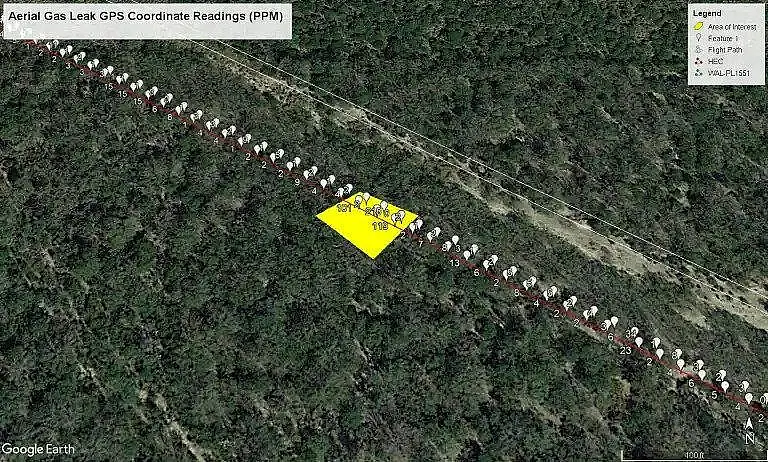
Drone methane leak detection uses airborne sensors to identify methane emissions from a safe offset position. In most commercial applications, that means pairing a professional drone platform with optical gas imaging payloads, thermal capabilities, and flight planning that reflects the site layout, weather conditions, and inspection objective.
The result is a more efficient way to assess assets where traditional methods can be slow, inconsistent, or risky. Crews do not need to physically access every elevated valve, flange, fitting, hatch, or vent stack just to begin locating a problem. Instead, the drone can scan broad areas first, help narrow down suspect zones, and provide clear visual context for maintenance teams.
That matters because methane leaks rarely happen on a convenient schedule or in convenient locations. Some are persistent and low-volume. Others are intermittent and tied to pressure changes, temperature shifts, or equipment cycling. A useful inspection method needs to adapt to those realities, not ignore them.
Why operators are shifting from manual-only inspections
Manual inspection still has a place. There are situations where a technician on the ground with handheld instruments is the right choice, especially for final confirmation, close-range testing, or repair verification. But manual-only programs can leave gaps on large or congested sites.
A drone changes the speed and coverage equation. It can inspect rooftops, flare systems, elevated pipe racks, storage infrastructure, and perimeter areas without requiring lifts or extensive shutdown coordination. That reduces field time and often improves consistency, especially when recurring inspections need to be performed across similar assets.
The biggest advantage is usually not replacing ground crews. It is making those crews more efficient. When the airborne inspection identifies likely leak locations first, technicians can go directly to the highest-priority areas with the right tools and a shorter path to resolution.
Where drone methane leak detection delivers the most value
The strongest use cases are environments where access, scale, or safety constraints make conventional inspections inefficient. Midstream infrastructure is a clear example. Pipeline corridors, compressor stations, and gas processing facilities often involve large footprints and a mix of elevated and confined areas.
Upstream and production sites also benefit, particularly where tank batteries, separators, and associated equipment create multiple possible leak points. Industrial facilities and landfills are another strong fit because emissions may originate from dispersed assets, irregular terrain, or active operational zones where foot access is limited.
In Texas, where energy infrastructure is extensive and conditions can change fast, the ability to deploy quickly and capture decision-grade field data can have real operational value. Not every site needs the same inspection approach, but many benefit from faster screening and better documentation.
How the inspection process works in the field
A professional methane detection mission starts before the aircraft leaves the ground. Site conditions, wind direction, temperature, air movement, asset layout, and the likely behavior of emissions all affect mission planning. If those variables are ignored, the output can look polished but offer limited inspection value.
The field team typically defines the inspection objective first. That may be broad screening across an entire facility, targeted review of specific components, follow-up after a repair, or recurring monitoring for compliance support. Flight paths are then planned to maximize line of sight, sensor effectiveness, and safe stand-off distance.
During flight, the pilot and sensor operator watch for plume behavior, emission signatures, and contextual visual clues that help pinpoint the source. Depending on the payload and conditions, the mission may include multiple passes from different angles to improve confidence. The deliverable is not just raw footage. It should identify where the suspected emission was observed, what asset appears involved, and what visual record supports that finding.
That distinction matters to commercial clients. A useful deliverable supports maintenance dispatch, engineering review, and documentation requirements. It should help teams act, not just watch.
The role of optical gas imaging and why platform quality matters
Optical gas imaging is one of the most effective tools available for visualizing methane emissions in commercial inspections. But the sensor is only part of the equation. Stable flight performance, experienced pilots, mission planning discipline, and knowledge of industrial environments all affect the result.
A lower-grade operation may collect imagery that is hard to interpret or poorly aligned with the asset register. A commercial inspection partner should understand how to fly around operating equipment, how to maintain safe positioning near sensitive infrastructure, and how to generate outputs that fit actual field workflows.
This is where service quality becomes more important than hardware marketing. The right aircraft and sensor package matter, but buyers are ultimately paying for reliable detection support, inspection efficiency, and usable reporting. If the final deliverable cannot be tied back to maintenance action or compliance documentation, the technology stack has not done its job.
Trade-offs buyers should understand
Drone methane leak detection is highly effective, but it is not magic. Weather matters. Wind can disperse plumes and make some emissions harder to visualize. Site congestion can limit certain flight paths. Intermittent leaks may require repeat passes or scheduled monitoring windows when equipment is under typical operating conditions.
It also does not eliminate the need for ground verification in every case. For some programs, the drone is best used as a first-pass screening and localization tool, followed by technician confirmation. For others, especially where access is difficult or risk is elevated, the drone may carry a much larger share of the inspection burden.
The right approach depends on the asset type, the inspection goal, and the consequence of missing a leak. Buyers should be cautious of any provider promising one method for every scenario. Good inspection planning is always situational.
What commercial buyers should expect from a provider
If methane inspections affect safety, uptime, environmental reporting, or asset integrity, the buying standard should be high. Clients should expect FAA-compliant operations, pilots who are experienced around industrial and energy assets, and deliverables built for field use rather than generic media output.
That includes clear reporting, location context, visual evidence, and practical communication with operations teams. Response time matters too. If a site issue needs fast deployment, the provider should be able to mobilize without turning a time-sensitive inspection into a scheduling problem.
For organizations that need recurring monitoring, consistency is just as important as speed. Repeatable flight methods, standardized reporting, and dependable data quality make it easier to compare findings over time and support internal asset management processes.
Drone methane leak detection as part of a broader inspection strategy
The best results usually come when airborne methane detection is treated as one part of a larger inspection program. It works well alongside thermal imaging, visual asset inspection, mapping, and engineering review. Together, those services give owners and operators a more complete picture of what is happening across the site.
That integrated view is often where the real value shows up. A methane plume is important on its own, but it becomes more actionable when paired with visual asset condition, site context, and precise documentation. That is how inspections move from observation to decision.
For companies that need commercially useful outputs, this is the difference between collecting interesting imagery and capturing data that can support maintenance planning, compliance response, and operational oversight. Providers like Drone Services Texas position methane inspection work around that standard – high-accuracy field capture, fast deployment, and deliverables teams can use immediately.
Methane detection is ultimately a speed-to-clarity problem. The faster you can identify likely emissions, document them well, and route the right people to the right location, the better your response. When that process needs to happen across active industrial assets, the most effective tool is often the one that gets above the problem and turns uncertainty into evidence.