A missed roof defect, an undocumented grading issue, or a delayed progress update can turn into a budget problem fast. That is why aerial data capture services matter on commercial projects. When the output is accurate, repeatable, and delivered in a format your team can use, drone operations stop being a marketing add-on and become part of how work gets managed.
For construction teams, engineers, asset owners, and facility operators, the value is not the aircraft itself. The value is the data. Good aerial operations produce current site visibility, measurable conditions, and decision-grade deliverables that reduce guesswork in the field. Poor aerial work produces attractive footage with little operational use. That distinction is where many buyers either gain efficiency or waste time.
What does aerial data capture services actually include ?
Aerial data capture services can cover a wide range of outputs depending on the asset, the stage of the project, and the decisions your team needs to make. On one site, that may mean orthomosaic mapping and for earthwork tracking. On another, it may mean thermal imaging for a building envelope assessment, optical gas imaging support for emissions monitoring, or high-resolution inspection imagery for elevated structures.
The common thread is that the service is built around usable information. That usually includes mission planning, FAA-compliant flight operations, sensor selection, data capture, processing, quality checks, and delivery in a format that fits project workflows. If the end result does not support engineering review, field coordination, documentation, compliance, or asset management, it is not doing enough for a commercial client.
This is also why scope matters. A property marketing video and a survey-grade topographic deliverable are not interchangeable. Both involve drones, but they require different planning, equipment, accuracy standards, and post-processing discipline. Commercial buyers are usually better served by defining the operational question first, then matching the flight and data method to that need.
Where aerial data capture services create the most value
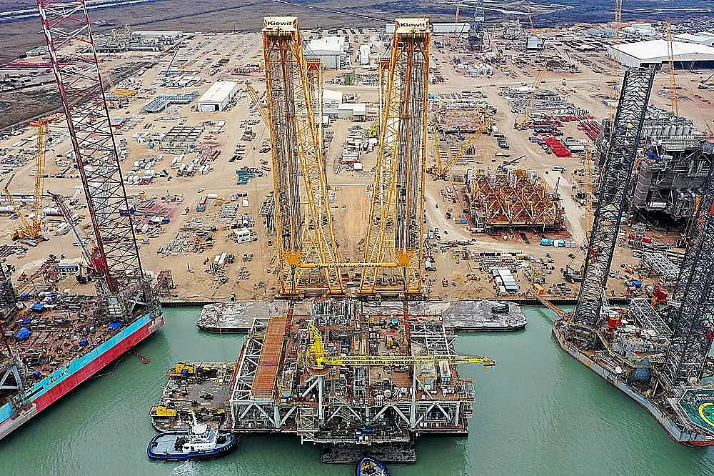
On active construction projects, aerial data capture services help teams maintain current visibility without sending staff across large sites every time someone needs an update. Progress documentation becomes easier to standardize when flights are repeated on the same path and schedule. That creates a visual record that can support owner reporting, trade coordination, schedule validation, and dispute resolution.
For civil and infrastructure work, the benefit often comes from scale and access. Roads, utility corridors, bridges, retention areas, and industrial yards are time-consuming to document manually. Drone-based mapping and inspection can cover these environments faster while limiting exposure to traffic, elevation, or uneven terrain. That does not eliminate ground verification, but it reduces how much of the site has to be handled through labor-intensive methods.
Energy and industrial operators tend to focus on risk, compliance, and uptime. In those settings, aerial thermal imaging and visual inspection can help identify anomalies without interrupting operations unnecessarily. Methane leak detection and optical gas imaging support are especially valuable when the cost of delayed detection is high and the inspection area is difficult to assess from the ground.
Commercial real estate stakeholders use aerial data differently. For them, the priority may be roof condition documentation, facade review, drainage assessment, site planning, or visual records for acquisition and asset management. The goal is still the same – get accurate information quickly, with minimal disruption to tenants, staff, or ongoing operations.
What separates useful data from generic drone output
Not all drone providers deliver the same level of value. The difference usually comes down to planning, precision, and how the final deliverables are structured. If a provider leads with cinematic footage when your team needs measurements, annotations, or thermal findings, that is a mismatch from the start.
Useful aerial data is collected with a clear operational purpose. Flight altitude, overlap, control, sensor type, weather conditions, and site constraints all affect output quality. So does consistency. If you are comparing progress over time or using imagery for analysis, repeatable capture matters as much as image clarity.
Post-processing is another major separator. Raw imagery has limited value for most commercial teams unless it is turned into orthomosaics, 3D models, point clouds, thermal reports, inspection photo sets, or other engineering-ready deliverables. The format should make review easier, not create more work for your staff.
There is also the issue of accuracy. Some projects need general visual context. Others require survey-aligned mapping or precision suitable for takeoffs, grading checks, or design coordination. Buyers should be careful not to assume every aerial map supports the same level of confidence. Accuracy claims should match the method, controls, and processing approach used on the project.
How to evaluate aerial data capture services
The right provider should be able to explain what data will be collected, how it will be captured, what level of accuracy is expected, and how the deliverables will support your workflow. If those answers stay vague, the service probably is too.
Start with the use case. Are you documenting progress, measuring stockpiles, inspecting a flare stack, checking for roof moisture, or building a current site model for planning? Each objective changes the mission profile. A strong commercial drone partner will scope around the decision you need to make, not just the flight time.
Then look at operational readiness. FAA compliance, insurance, safety procedures, and the ability to work in complex environments are baseline requirements for serious commercial work. On some sites, waiver-backed flight capability, coordination with facility teams, and experience around active operations matter just as much as the aircraft platform.
Ask about deliverables in plain terms. Will your team receive georeferenced imagery, a CAD-compatible model, thermal analysis, annotated inspection photos, or recurring reports on a fixed schedule? The answer should be specific. Decision-makers do not need more media. They need outputs that fit engineering review, project controls, compliance documentation, or asset maintenance planning.
Turnaround time matters too, but speed only helps if quality holds. Fast deployment is valuable when weather, schedule pressure, or incident response compress the timeline. Still, the real question is whether the provider can deliver usable high-accuracy precision data without creating rework later.
Trade-offs buyers should understand
Aerial data capture is powerful, but it is not a replacement for every ground-based method. Dense vegetation can limit surface visibility. Reflective materials can affect some sensors. Weather, airspace restrictions, and site activity can narrow the flight window. On complex projects, the best result often comes from combining drone data with traditional surveying, field verification, or other inspection methods.
There is also a trade-off between speed and rigor. A quick visual flight may be enough for an executive update or broad condition review. It will not produce the same level of defensible measurement as a properly controlled mapping mission. Likewise, a thermal scan can help identify anomalies, but interpretation still requires experience and sometimes follow-up inspection to confirm the cause.
That is not a limitation so much as a planning issue. When expectations are set correctly, aerial capture becomes one of the most efficient ways to expand visibility and improve response time across large, active, or hard-to-access assets.
Why commercial teams are shifting toward repeatable aerial capture
The biggest change in this market is that buyers are no longer asking whether drones can collect data. They are asking whether the outputs are reliable enough to support decisions. That shift favors providers who understand construction sequencing, industrial inspection, infrastructure constraints, and compliance-driven documentation.
Repeatability is a major reason. When flights are performed on a consistent schedule with consistent methods, teams can compare conditions over time instead of reacting to isolated snapshots. That supports better forecasting, cleaner reporting, and earlier identification of issues that would otherwise stay hidden until they become expensive.
It also changes how organizations manage field resources. Instead of sending personnel repeatedly into areas that are difficult, elevated, or spread across hundreds of acres, teams can review current conditions remotely and dispatch people only when follow-up work is necessary. That saves time, reduces exposure, and improves how site information moves from the field to the decision-maker.
For companies managing assets across Texas and beyond, that operational efficiency adds up quickly. The best aerial programs are not built around aircraft. They are built around measurable outputs, predictable deployment, and data that can be acted on immediately.
When you evaluate aerial data capture services, the smart question is simple: what decision will this help us make faster and with more confidence? If the answer is clear, the investment usually makes sense. If it is not, the scope needs work before the propellers ever start spinning.