

If you own or manage a building in Houston, you already know how brutal this climate can be on a roof, an electrical system, or a solar array. Between the summer heat, the humidity rolling in off the Gulf, and the occasional hurricane, problems hide in places you can’t see with your eyes alone. That’s exactly where drone thermal imaging services in Houston come in. Instead of sending a technician up a ladder to guess where a leak might be, an infrared sensor mounted on a drone can map temperature differences across an entire roof, wall, or piece of equipment in minutes, revealing moisture, heat loss, or electrical faults long before they turn into expensive repairs.
At Professional Drone Services of Texas, we’ve built our thermal imaging drone program around one simple idea: give property owners, contractors, and facility managers data they can actually act on, not just a pretty aerial photo. This guide walks through how the technology works, what it costs, which drones we fly, and how to know if an infrared drone inspection is right for your property.
What Is Drone Thermal Imaging and How Does It Work
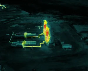
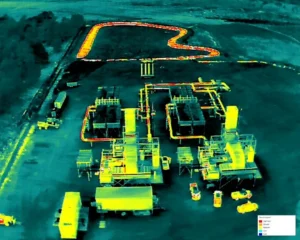
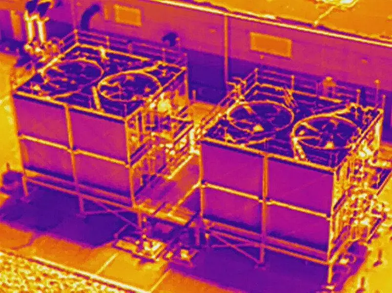
Thermal imaging drones carry a specialized sensor that detects infrared radiation, the heat energy every object gives off, rather than visible light. The sensor converts those temperature readings into a color-coded image called a thermogram, where warmer areas typically show up in reds and yellows and cooler areas appear in blues and purples. A trained operator then reads that image to spot anomalies: a hot spot on an electrical panel that shouldn’t be hot, a cool streak on a roof membrane where water has soaked into the insulation, or uneven heating on a solar panel that signals a failing cell.
What makes drones so useful here is elevation and speed. A handheld thermal camera can only capture what’s directly in front of it, and getting that angle on a large commercial roof or a 40-foot electrical tower usually means renting a lift or risking a technician’s safety. A drone can cover the same area from a safe, consistent altitude in a fraction of the time, capturing hundreds of data points in a single flight and stitching them into a full thermal map of the structure.
Why Houston Properties Need Infrared Drone Inspections
Houston’s weather is uniquely hard on buildings, and that’s a big part of why demand for thermal drone inspection in Houston, TX has grown so quickly over the last few years.
- High humidity accelerates hidden moisture damage. Once water gets under a roof membrane or into a wall cavity, Houston’s humidity keeps it from drying out naturally, which speeds up mold growth and structural decay.
- Hurricane and severe storm exposure. Wind-driven rain during tropical storms can force water under shingles or membrane seams without leaving any visible sign on the surface.
- Extreme summer heat stresses HVAC and electrical systems. Overloaded circuits and failing components run hotter than normal, and thermal imaging catches that before a breaker trips or a fire risk develops.
- Rapid solar adoption across the metro area. Houston has seen a sharp rise in commercial and residential solar installations, and thermal scans are the fastest way to confirm panels are performing as they should.
These conditions mean a thermal inspection that might be optional in a drier, milder climate is often a genuinely smart investment here, whether you’re maintaining a warehouse roof in Pasadena or managing a solar farm out toward Katy.
Where Drone Thermal Imaging Gets Used Most
Commercial and Residential Roof Inspections
This is the single most common request we get. A commercial roof thermal inspection in Houston can identify trapped moisture under a flat or low-slope membrane roof, which is nearly impossible to spot with a visual inspection alone. Catching a leak early, before it spreads across the whole roof deck, can be the difference between a small membrane repair and a full roof replacement.
Solar Panel Thermal Imaging
Solar panel thermal imaging in Houston has become one of our fastest-growing services. A flight over a solar array can flag underperforming panels, loose connections, or cell damage in a fraction of the time it would take a technician to test each panel by hand. For large commercial arrays, this translates directly into faster maintenance and less lost energy production.
Electrical and Utility Infrastructure
Substations, transformers, and overhead power lines generate heat as a normal part of operation, but excess heat usually points to a loose connection, overloaded circuit, or failing component. A FLIR drone inspection in Houston lets utility contractors check large sections of infrastructure without shutting down equipment or putting a technician near live electrical components.
Construction and Building Envelope Inspections
During and after construction, thermal imaging can verify that insulation was installed correctly and that there are no air leaks around windows, doors, or seams in the building envelope. This is increasingly requested for LEED certification documentation and energy audits across the Houston commercial market.
Agricultural and Land Use Surveys
Thermal drones can also detect irrigation problems, livestock in dense brush, or drainage issues across large tracts of land, which is useful for property owners managing rural or semi-rural land just outside the Houston metro.
How Much Is a Thermal Drone? (And What It Means for Service Pricing)
This is one of the most common questions we get, so let’s answer it directly: consumer-level thermal drones start around $2,500 to $4,000, while professional-grade thermal imaging drones used for commercial inspection work typically run anywhere from $8,000 to $25,000 or more, depending on the sensor resolution and drone platform. Higher-end enterprise systems with radiometric thermal cameras and long-range capability can push past $30,000.
That price range explains why hiring a professional drone thermal imaging service is almost always more practical than buying equipment yourself, especially for a one-time or occasional need. When you factor in FAA licensing, insurance, sensor calibration, and the training required to actually interpret thermal data correctly, the cost of ownership adds up fast for a business that only needs a handful of inspections a year.
How Much Is a Drone with Thermal Imaging Compared to Hiring a Service?
If you’re weighing whether to buy your own equipment or hire a thermal imaging drone company in Houston, the math usually favors hiring out unless you plan to run inspections on a near-daily basis. A single professional-grade thermal drone with a radiometric sensor can cost more than an entire year of contracted inspection services for a mid-sized commercial property. On top of the hardware cost, you’d also need a licensed Part 107 remote pilot on staff, liability insurance, and someone trained specifically in reading thermal data, since a raw thermal image means very little without proper analysis.
Most property owners, contractors, and facility managers find it far more cost-effective to book inspections as needed through a company that already owns calibrated equipment and employs certified pilots.
Is Infrared and Thermal the Same Thing?
Not exactly, and this is a common point of confusion. Infrared is a broad section of the electromagnetic spectrum that includes several wavelength ranges, including near-infrared, used in things like night vision, and long-wave infrared, which is what thermal cameras actually detect. Thermal imaging specifically refers to capturing long-wave infrared radiation to measure and visualize surface temperature. So while all thermal imaging is a type of infrared technology, not all infrared imaging is thermal. In everyday industry conversation, though, the terms “infrared drone inspection” and “thermal drone inspection” are used interchangeably, and that’s exactly how we use them across our services.
Which Drones Have Thermal Imaging?
Several commercial drone platforms now come equipped with dedicated thermal sensors, and the right choice depends on the size of the job. Some of the most widely used thermal imaging drones in the industry, including in our own fleet, include:
- DJI Mavic 3 Thermal (Mavic 3T): A compact, versatile platform combining a high-resolution visual camera with a radiometric thermal sensor, well suited for roof and building inspections.
- DJI Matrice 30T: A rugged, enterprise-grade drone built for utility and infrastructure inspection, with a longer flight time and more advanced thermal resolution.
- Autel EVO II Dual 640T: Known for its high thermal resolution, popular for search and rescue and large-scale industrial inspection work.
- DJI Zenmuse H20T (paired with the Matrice 300 series): A heavy-duty combination used for large commercial and utility-scale projects requiring maximum range and sensor precision.
We select the platform based on the scope of your project, whether that’s a single residential roof or a multi-building commercial portfolio.
Where to Get a Drone Thermal Imaging Service in Houston
If you’re searching for where to get a drone thermal imaging service in Houston, the most important thing to verify is that the provider is a properly licensed and insured operation, not just someone with a consumer drone and a thermal attachment. Look for:
- FAA Part 107 certification for every pilot conducting the flight, which is legally required for commercial drone operations.
- Liability insurance covering the property being inspected.
- Radiometric thermal sensors, which capture actual temperature data rather than just a colorized heat picture, since only radiometric data can be analyzed precisely after the flight.
- A written inspection report, not just raw footage, that translates the thermal data into clear findings you can act on.
Professional Drone Services of Texas meets all of these standards, and our team has flown thermal inspections across residential neighborhoods, commercial districts, and industrial sites throughout the greater Houston area.
Our Thermal Drone Inspection Process
Here’s what a typical infrared drone inspection with our team looks like, from booking to final report:
- Initial consultation. We discuss the property, the specific concern (a suspected leak, solar underperformance, an overheating electrical panel), and confirm the scope of the flight.
- Flight scheduling around thermal conditions. Thermal inspections aren’t done at any random time of day. We typically fly during periods of maximum thermal differential, often early morning or shortly after sunset, when temperature contrasts between wet and dry, or faulty and functioning, areas are most visible.
- Pre-flight safety and airspace check. We verify local airspace restrictions, weather conditions, and equipment calibration before every flight.
- The flight itself. The drone captures both thermal and standard visual imagery, allowing us to cross-reference exactly where an anomaly sits on the physical structure.
- Data analysis. Our team reviews the radiometric thermal data, identifies temperature anomalies, and cross-checks them against the visual imagery to rule out false positives like reflective surfaces or shadows.
- Final report delivery. You receive a clear, annotated report with thermal images, visual comparisons, and a written summary of findings, so you know exactly what was found and where.
Why Choose Professional Drone Services of Texas
Houston has no shortage of drone operators, but thermal imaging is a specialized skill that goes well beyond flying a drone safely. Reading a thermal image correctly, telling the difference between a genuine moisture intrusion and a reflection from a rooftop HVAC unit, takes real training and repetition.
Our team holds active FAA Part 107 certification, carries full commercial liability insurance, and flies enterprise-grade radiometric thermal sensors rather than consumer-level equipment. We’ve completed inspections across residential roofs, commercial warehouses, solar installations, and utility infrastructure throughout Houston and the surrounding areas, and every report we deliver is built to be genuinely useful, not just a stack of colorful images with no explanation attached.
Whether you need a single roof inspection after a storm or ongoing thermal monitoring for a commercial property portfolio, our goal is to give you accurate, actionable data delivered fast.
Get Your Thermal Imaging Drone Inspection Scheduled
Hidden moisture, failing solar cells, and overheating electrical components rarely announce themselves until the damage is already expensive to fix. A thermal imaging drone inspection gives you a clear, data-backed look at what’s really happening on your property, before a small issue becomes a major repair bill.
Contact Professional Drone Services of Texas today to schedule your drone thermal imaging inspection in Houston and get a detailed report you can actually use.
FAQ’s
How much is a thermal drone?
Consumer thermal drones start around $2,500 to $4,000, while professional-grade commercial units range from $8,000 to $25,000 or more. Price depends on sensor resolution, flight range, and whether the camera captures radiometric temperature data or just a visual heat overlay.
Is infrared and thermal the same?
Not exactly. Infrared covers a broad spectrum of wavelengths, while thermal imaging specifically captures long-wave infrared to measure surface temperature. All thermal imaging is infrared-based, but not all infrared technology is thermal.
How much is a drone with thermal imaging?
Drones equipped with dedicated thermal sensors typically cost between $3,500 and $30,000, depending on the platform and sensor quality. Most property owners find it more affordable to hire a licensed inspection service rather than purchase and maintain their own equipment.
Which drones have thermal imaging?
Popular thermal imaging drone models include the DJI Mavic 3T, DJI Matrice 30T, Autel EVO II Dual 640T, and the DJI Zenmuse H20T paired with the Matrice 300 series. Each is suited to different inspection scales, from single roofs to large utility infrastructure.
Where to get a drone thermal imaging service in Houston?
Professional Drone Services of Texas provides licensed, insured thermal imaging drone inspections throughout Houston and the surrounding area, covering roofs, solar arrays, electrical systems, and commercial buildings, with detailed reports included.
How long does a thermal drone inspection take?
Most residential inspections take under an hour on site, while larger commercial properties may take a few hours depending on size. Report delivery typically follows within a few business days after the flight and data analysis are complete.