Wayne

The Role of Aerial Photography in Commercial Real Estate Marketing

Aerial Photography

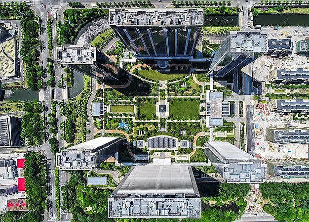
The commercial real estate industry is highly competitive. High-quality visuals can make a significant difference in attracting buyers and investors. Houston Aerial Photography Company provides advanced drone imaging solutions that help showcase properties in the best light. Aerial images and videos give potential clients a comprehensive view of a property’s layout, surroundings, and accessibility. Benefits … The Role of Aerial Photography in Commercial Real Estate Marketing

How Drone Video Services Can Improve Real Estate Listings

High-quality visuals play a key role in attracting buyers. Standard property photos often fail to showcase a property’s full potential. Drone video services provide a unique perspective, capturing the layout, landscape, and surrounding areas in a way that traditional photography cannot. Aerial footage makes listings more visually appealing, increasing buyer interest and engagement. Aerial videos … How Drone Video Services Can Improve Real Estate Listings

Exploring the Benefits of Professional Drone Services

Technology is changing how businesses inspect, survey, and monitor their properties. Traditional inspection methods take time, cost a lot, and can be risky. Drone service near you offers a fast and cost-effective way to gather data, improve safety, and enhance efficiency. From real estate assessments to construction monitoring, drones provide accurate insights that help businesses … Exploring the Benefits of Professional Drone Services

Detecting Structural Issues Early with Advanced Drone Imagery Services

Structural issue detection with drone

Buildings and infrastructure need regular inspections to stay safe. Finding problems early helps avoid costly repairs and safety risks. Traditional inspections take time, cost a lot, and can be dangerous. Drone commercial services offer a faster, safer, and cheaper way to check buildings. How Drones Help in Structural Inspections Manual inspections can miss small cracks … Detecting Structural Issues Early with Advanced Drone Imagery Services

How Drones Are Changing the Landscape of Property Surveys and Land Assessments

Property surveys and land assessments have traditionally been time-consuming and labor-intensive tasks. Surveyors, land developers, and urban planners have relied on manual tools, maps, and equipment to measure and assess land. However, the introduction of aerial drone services has completely changed how these tasks are performed, making them faster, more accurate, and cost-effective. But how … How Drones Are Changing the Landscape of Property Surveys and Land Assessments

The Future of Drone Videography: What’s Next for the Industry?

Drone Videography

Drone videography has already changed the way we capture and experience visual content, from breathtaking aerial shots in movies to real-time coverage of live events. But what does the future hold for this technology? As drones continue to evolve, so too does their role in videography. From improved camera quality to expanded uses in different … The Future of Drone Videography: What’s Next for the Industry?

Request a Quote